
Murrindindi Cascades is situated near the south end of Murrindindi River in Murrindindi Scenic Reserve,that can be accessed via Maroondah and Melba Highway. Closest town is Glenburn and 6-7 km further to the turn off at Devlins Bridge with signposted access of 9 km on Murrindindi Road. There are several camping areas along the river. Camping fee with flexi way of payment is $7 a car per night. BYO drinking water.


Ferns Camping Area with two flush toilets and a sink. Car was parked at site no.62
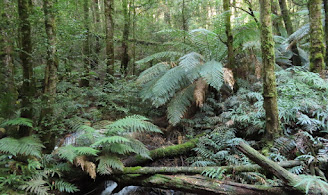
Also: there is a bird on the tent and the bird is an Eastern Yellow Robin.
The car false floor with a pull out table and a cutlery utensil drawer were handy for meal times and getting ready before leaving for a walk. Love it and thank Allan for his great work. And also, about 15 minutes was spent on setting up the mini canopy for the tent. This was the second time I tried it out and the first one had been years ago. Could use the car awning, instead.
Day One: Murrindindi Cascades On Foot or Murrindindi River South Day Walk, VicMAP


GPS Tracklog of Murrindindi Cascades On Foot on short steep hills and formed track.
Length: 12.4 km. Time: 4 hours. Ascent 523 m and Descent 533 m.
It was getting rather late and so decided to do the Murrindindi River South. Started from Ferns Camp then followed Camp Link Track to Bull Creek Camp. Continued south east for 2.5 km, crossed the river then walked south 1 km to reach Bull Creek junction. From here the track swings south-west and the climb starts: about 140 m up to the cascades.


Murrindindi Cascades in early evening with low light.
It was only a quick visit because we did not have enough time for photography. A revisit on the drive out was a possibility. Cascades water was great and we stopped for a drink before heading back to the track junction, that leads to the picnic area. As it was getting late, Murrindindi Road was the best option to take for the walk back to camp. Miso soup and freeze dried curry were for our first dinner on the trip.
We hit the sack at about 10.00pm.
Day Two: Wilhelmina Falls Walk and Boroondara Track Circuit
10 km, 3-4 hours, formed tracks and rather steep.


We had a long lunch break near Grassy Flat and when we were about to continue, we saw a helicopter heading towards Wilhelmina Falls then scouting over it again and again. There was a report about the event at Wilhelmina Falls; hence, Allan tried email to his parents, but the message was not sent.
At the track junction to a lookout at the base of Wilhelmina Falls, we were requested to return to the main track. We had to do so and continued climbing the well-constructed steps to a viewing platform.
Video clips taken near the Grassy Flat, mainly from the viewing platform with Helicopter Rescue flying away with the injured, a young girl who had had a fall, that caused a damage to her leg. There were about 10 rescuers on the ground: the CFA and the police.
At the viewing platform, a check on the email message confirmed that it was also not gone through. However, a phone call was successfully made. Leaving the lookout, continued north-east for 200m to a junction in a small clearing, the meeting place for those involved in the rescue. It's possible that they had drove in via Wilhelmina Falls Rd, SEC Rd and Jacksons Rd. We heard them on the way out when we turned onto the Boroondara Track.
The track heads south for 500 m then east and swings around to the south-west for another 500 m. Then, it was a long steep descent for about 1 km before swinging south for 500 m then east gently down to a creek. Follow the creek south-west for 800 m to meet Falls Creek Rd. Turn right and follow Falls Creek Rd for 100 m to reach Murrindindi River Track, where we started earlier on the day. The Ferns Camp was almost full as expected. Dinner included soup, freeze dried food, desert and tea. Sleeping time was around 9.00pm.
Day Three: Murrindindi Cascades
the first 600 m of Murrindindi River Walk
Started from Cascades picnic area. Followed the stepped track down to the base of the Cascades.
Reasons to pay a revisit:
- Photography with morning sun
- On way to the next planned walk


Upper Murrindindi Cascades video clip with background music

Murrindindi Cascades photos with silky look were taken by Allan, who had a better camera. It's true that you get what you pay for. It was worth to comeback here. After leaving the cascades, we had lunch at the picnic area, where we could try out the car awning. I'm rather happy with it because it took less than 5 minutes for us to put it up and probably about 10 minutes for one to do so.
It was a short and pleasant drive from Murrindindi Cascades to Wirrawilla Rainforest. Many rosellas could be seen on the way. We had walked Myrtle Gully and Tanglefoot Tracks (or Myrtle Gully circuit) many years ago; therefore, it was time for Sylvia Creek. I carried an out-dated Rooftop's map, did not consult my GPS (didn't listen to Allan) and the scrubs-filled path was so inviting; therefore, a mistake was made at the track junction. We should keep going south walking Quarry Track, instead of turning and heading north-east towards Tanglefoot Track. As a result, we finished early and had time for the side trip around Wirrawilla Rainforest.


GPS Tracklog of Sylvia Creek Walk and Sidetrip around Wirrawilla Rainforest
Distance: 4.31km in 1hour and 30minutes


A leech bite mark was found on Allan's leg and it's unsure if it was the one he flicked off on the walking track. He also brought home the second and it was found on the tile wall in the shower.

Meal with a bottle of Watts River Brewing in Healesville
Allan to me after the trip
"Thanks very much for paying for the camp fees. I must admit that
it had slipped my mind. That is the way all camping fees should be
paid. You can't know whether you will be able to use the site until you
get there or whether a suitable site can even be found. If there is
mobile coverage at the site then paying as you camp is the obvious way
to do it."