Ah Kow Tk – Lerderderg River – Bears Head Range Tk – Blackwood Ranges Tk
Update to the existing 3 to 4 day Lerderderg Gorge walk
undertaken two years ago (Watties Creek (Clearwater Crk) and The Old River Circuit Walk)
The difference between the two were:
Walked in and went down to the Lerderderg River via the Ah
Kow Track, unlike the previous walk, where I walked up the steep ascent from
the river, and then walked out.
The reason for the return was to identify how I had missed
out the Ah Kow Track on the ascent, and to find the start of the route which
led down to “a waterfall” located south of The Old River.
I suggest:
- For a short overnight walk, leave early morning. If you want an early start, camp can be set up at the start of Bears Head Range Track. If a late start, the night can be spent at Ah Kow camping area located just on the opposite bank of the Lerderderg River.
- Take
your time on the steep descent down to the Lerderderg River. A trekking pole can be very
helpful. The track is so steep
that I had to slide down on my backside.
- The
river was not flowing when we were there.
Only one or two decent pools of drinkable water along
the dry river bed. There may be a
need to treat water.
 Ah Kow Tk – Lerderderg River – Bears Head Range Tk – Blackwood Ranges TkThe walk started and ended at 65 Lohs Lane, which was about 600m south of Mt Black Wood. There was a signpost at the gate. Went through the gate, passed some worn red rail carriages, and continued on until reaching a signpost at the end of Lohs Lane, which showed Blackwood Ranges Track (about 250m from the starting point). Turned right here and headed 130m southeast which saw us at an entry gate into the park. Then, another 107m took us to the junction of Ah Kow and Blackwood Ranges Tracks, where route finding skills were required to find the start of Ah Kow Tk, which used to be an old vehicle track.
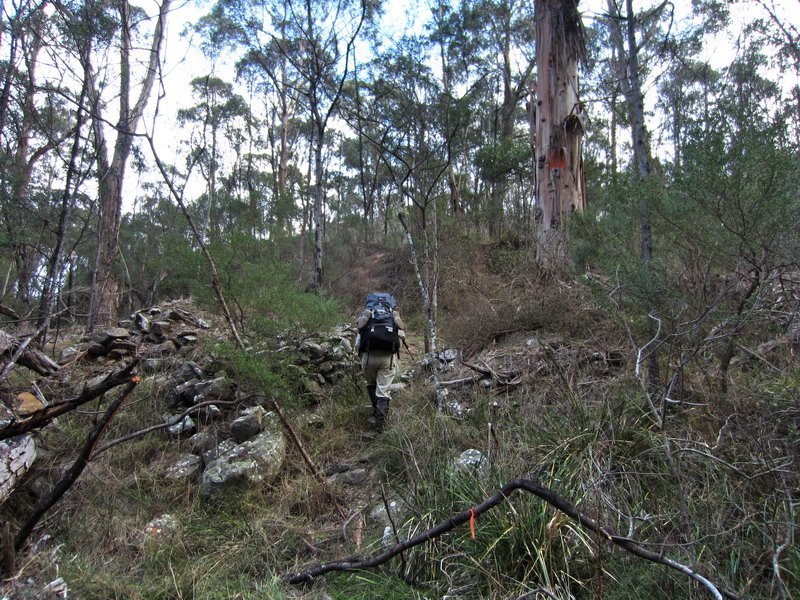
 The start of Ah Kow TrackThe track now turned northeast and after a pleasant walk along for 1.06 km, we arrived at a memorial of a Melton bushwalker, which was located on a knoll at 559m. From here, the track became narrow and the closer we got to the gorge, the steeper the track was. Care should be taken on a 140m steep descent to an emergency marker LER 513 on the bank of the Lerderderg River.
 Emergency marker LER 513 on the river bank
 Ah Kow Track Information
As suggested, the Ah Kow mine site and/or camping area was just on the opposite bank of the river, where a group of Chinese had lived and grown vegetable for food in the late 1870s. Keep an eye out for a plastic orange triangle on a big tree and an emergency marker, LER 514 could be seen up there too. A plastic orange triangle on a big tree
 Ah Kow camping area
 Ah Kow Ruin / Lerderderg River Track Info
The section from Ah Kow Tk to Bears Head Range Tk was dry. The walk mainly followed the dry rocky riverbed downstream for about 2.3 km until the Old River on the left was reached. Lerderderg RiverWalked a further 100m to reach the Bears Head Range campsite, which is located on a small grassy flat above the right hand bank of the river, which is also the start of the Bears Head Range Track.
However, there were sufficient pools of water available in the river bed to provide water for cooking and the climb out. So if you're heading into this section of the river, bring something to treat your water
 One of few pools of water in the river bed
 Reaching the Bears Head Range campsite
Allan doing the packing
The climb up the Bear Head Range track was extremely steep (the grade is 1 in 6 average) and required careful choice of route to avoid pack hauling narrow crevices.. There are lots of good views of the river on the way up and it is rather well marked with white triangles on the trees. The start of Bears Head Range Track

Lerderderg Gorge
Me on Bears Head Range Tk with Blackwood Ranges in the background


After 1.5 km the slope eases to 1 in 10 and the whole climb took about 2 hours.Once the Blackwood Range track was reached, the walker can either take the left turn to go around the Ah Kow Reference Area or the right turn to take the walker’s track around the locked vehicle gate to follow a short four wheel drive track to the junction of the Foxy Range Track, where a right turn takes the walker back to the Ah Kow Track junction, and then allows the walker to retrace steps back to Lohs Lane carpark.
Junction with Blackwood Ranges Track
 Blackwood Ranges Track / Bears Head Track Info
 The walking track around the locked vehicle gate
A challenging daywalk, or a comfortable overnight walk. See the elevation profile of the route taken until reaching the Blackwood Ranges Track.