Walks near Lorne
The drive: West Gate Bridge (M1) - Geelong bypass (A1) - Winchelsea turn off (C151) -
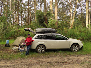
Dean Marsh - Benwerrin with a camping ground on the way to Lorne.
Wild camping due to the fully-booked campground on Saturday night. BYO potty
Day One: On Top Of Goslings Falls:
- Northwest of Lorne
- Start/End: Neck Track on Benwerrin - Mt Sabine Road
- Distance: 5 km marked with pink ribbons.
- Moving time by two oldies over 60's: about 2 hours 30 minutes
- Best time to walk: Spring. Avoid wet days and watch out for snakes on sunny days. Wear long pants, gaiters and gloves.
GPS track and profile of Goslings Falls Walk.
Walk the fire trail Neck Track for about 600 m to a knoll. Leave the Neck Track, turn right onto a narrow foot path, and the first marker (a pink ribbon) can be spotted after a further 20 m of walking.
The track was rather scrubby and the sun was out. It was a mistake to not put my long pants on.
About half of the way down to the creek, a snake was seen on the track, lying across the path. It did not know that it was being watched. To move the snake, we stamped on the ground and finally, it made a move, slithering quickly into the low scrubs, after feeling the ground vibration. It was the first snake we had spotted since the CoVid lockdowns in Victoria were lifted.
The track was rather steep when we got close to the creek. On reaching the creek, we were unable to follow the creek bed to get to the bottom of Goslings Falls because of fallen trees. It was about 100 m away to the north.
We continued on and we hit the All Trails marked track (All Trail GPX file of Goslings Falls Loop with the start from Wickhams Trk). Then, it was a steep descent to the top of the falls, from which we could only see just the valley. Our attempt to look for a viewing spot for the falls also failed. The descent to the bottom of the falls looked very steep and so we gave up. What a disappoinment! Then, the track turned west and up about 250 m, then turned north, running paralell with the creek and then the track went west again about 250 m to reach the Neck Track. Not far now: about half of km to the knoll, the turn off for the creek this morning and a further 600 m back to the car.
Once we got back to the car and campsite there was still enough time left for a short walk as Daylight Saving means longer days. So we decided to visit Erskine Falls and then Lorne for dinner.
Late Afternoon Visit to Erskine Falls and Dinner in Lorne
Day Two: Terrace Falls and Pennyroyal Falls
After feeding the King Parrots at the campground, we went to the south end of the Dunse Track to start the walk, but because of road work on the Dunse Track, a planned loop of Terrace, Pennyroyal, Acquila and Wymbooliel Falls via the Dunse Tk was abandoned. Instead, only Terrace Falls and Pennyroyal Falls were visited via the north end of the Dunse Tk.
King Parrots at campsite,
GPS Track with the falls on Acquila Creek. The OSMap was used because it's updated regularly
The left bank before Terrace Falls where a black snake was seen.
Unnamed falls (R) where I found my first leech, while trying to take photographs and video clips.
Terrace Falls (L) and Pennyroyal Falls (R)
Waterfalls on Acquila Creek in Otways
Something unexpectedly took place at the Pennyroyal Falls. Allan lost his footing and had a minor fall while trying to find a seating spot for lunch at the base of the Falls. A bit of first aid was needed and a spray-on plaster was put in good use. We returned to the camping ground and relaxed. King parrots provided good company and amusement, then hot water was needed for the soup and to rehydrate the meal. Our neighbors were two young ladies who travelled in a small hatchback that was used for their sleeping platform with the hatch opened throughout the night.
An excellent campground with basic facilities including two long drop loos and a water tank.
The fees charged were also reasonable. We camped here for three nights.
Day Three: We attempted to walk to Wanliss Falls but failed to be able to follow the All Trails route. There was only one gpx file for this walk on All Trails and it was not a curated track either, so the track that hadn't been checked out by All Trails.
The start of the Wanliss Falls track is at the junction of Benwerrin-Mt Sabin Rd and Dunse Track.
Wanliss Falls are located just few kms Northwest of Erskine Falls and about 5 kms South of this junction. The walking track from the junction was so well-defined that we followed it and not the All-Trails route and so got well off track. We had not stopped to consult our navigational aids such as map, gps and compass, and so missed the point where we should have left the well-defined track to head south for the falls. If we had continued onward, we would have been led down to the top of Erskine Falls on the Erskine River. We back-tracked (a snake seen here earlier) and tried to locate the correct route, but failed. It was over-grown and the scrub was thick. The day was also humid. It was too warm to go on and so we both gave up with this route.
GPX file of Wanliss Falls on All Trail (L), Vicmap Topo
Our GPX route of Wymbooliel Falls (R), VICMAP
So the alternative was to walk to the Wymbooliel Falls via the Pennyroyal Track (or Pennyroyal East Link Tk on OSM) as it was so close. There were several alternative ways to get to the Wymbooliel Falls and we chose the short one. When we got back to the car, we drove to the Pennyroyal Tk, had lunch at the gate, then set off to the Falls.
The turn off was just about 200 m away down the Pennyroyal Track and marked with a yellow ribbon tape tied around a big tree. After leaving Pennyroyal Track, it was about 400 m walk west to take us down to the creek and track junction. After a quick visit to Wymbooliel Lower Falls, we returned to the junction and then walked about 30 m up the main creek and found the start of the track to take us to Wymbooliel Upper Falls on the right.
Wymbooliel Lower Falls
The route was well-marked with pink ribbons and the distance to the steep descent was only about 150 m. The turn-off down to the falls was extremely steep and care should be taken if you attempt it. A 20 m to 30 m rope is almost essential to get you down to the bottom of Falls. We didn't have a rope so we gave up when we were only about half way down.
On the way down to the upper falls
The Last Day's Morning: Straw Falls, Splitter Falls and Erskine Falls
We drove to our campsite via the inland route from Melbourne. Hence, we wanted to drive back via the coast with some interesting stops on the way and Straw Falls and Splitter Falls were chosen. We had been to these falls some years ago in a dry season. There had been lots of rain in The Otways recently and so the falls should have been worth revisiting. A plan was not needed. Just follow the Erskine River Walking Track from Erskine Falls.
Straw Falls
Waterfalls on Erskine River
The Straw Falls were great but the Splitter Falls were difficult to view from the Erskine River walking track and the Splitter Falls themselves were inaccessible from the track. However,
on the return walk back to Erskine Falls, there were a few accessible
minor falls and cascades that were well worth a short bush-bash to get
close to the falls.
Unnamed Falls (L) and Splitter Falls (R)
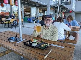
After leaving the falls, we drove down to Lorne for a fish and chips lunch.