
Redbank Gorge to Standley Chasm

Parks NT Park Map with walking photos by me
Thursday 13th of June:
Fly from Melbourne to Alice Springs on Tiger Airways and stay at YHA Alice Springs for two nights. Visit to Tourism Central Australia Visitor Centre on Gregory
Terrace for information on key to collect food drops and to the Lone Dingo bush walking store. These are located just minutes from the YHA.
Friday 14th:
Friday 14th:
Buy gas & food for lunch & dinner cooking such as wraps, crackers, peanut butter, cream cheese, and vegemite. Supermarkets are also very close to the YHA.
Pick up the food-drop key from The Tourism Office with the deposit of $50, then take a walk along Todd Rive in the afternoon.
The last thing I do for the day is to top-up the charge for the mobile phone because there won't be any chance to do that along the Larapinta Trail.

Todd River - Alice Springs
Saturday 15th:
Leave Alice Springs on a charter transport to Redbank Gorge at 2.30pm (not 2.00pm as booked. The transfer operator is late) with 3 food drops to be placed at
Stanley Chasm, Ellery Creek and Ormiston Gorge.
Share transport with Mullet (Vic), Forest (NSW), Bellie (Qld), and Phil & Joyce (contacts via a bushwalk forum). We have fun with a rock wallaby by the roadside near the car park, arrive in late afternoon and set up tents at the walk-in campsite at Redbank Creek just before it gets dark.


Redbank Creek campsite, where a dingo is spotted (L) and
Redbank Hill from campsite (R)
Sunday 16th:Day trip to Mt Sonder and back (Section 12 - Grade: medium, 15.8km) then a side trip to Redbank Gorge and the lookout in the afternoon.
If my memory serves me correctly, I am awoken at 2.30am by a noisy guided group of walkers, who probably stayed in the car camping area on the hill and are heading for the Mt Sonder summit at dawn. A bit later, I also hear others in our group leaving. I also get up early, but end up leaving at around 7.00am. My misplaced fit-over glasses are holding me up a bit and I am quite sure that I am the last to leave.
About half of the way up, I meet those from our group and the guided group, who are on the way back down. Near the summit, I meet Don Fry (and his colleague?), Superintendent, Central Desert Division, Southern Command, NT Police, who is very friendly and helpful and offers his sun-glasses, which I politely refuse. Later, we meet again and this time I can not say no to his mandarin (in fact, two are offered).
I enjoy lunch on the summit of Mt Sonder with 360º views of Mt Zeil, the highest in The NT 1531m in the northwest, Mt Razorback 1274m and Redbank Hill 1111m in the west, Ormiston Pound and Mt Giles 1389m in the east. Here, with Telstra service, I can send a text message and receive a phone call from my closest friend, who lets me know the weather forecast for the next few days. A couple arrive a bit later and so there is a photo opportunity. We take turn for a pose. I am the last to leave the summit with some stops at the lookouts on the way down and see a dingo wandering around the campsite, at which there is only my tent left. The others continue on.
After a quick afternoon tea, I set off again and this time to make a visit to Redbank Gorge, then climb up The Lookout near the car park, where I meet two women, who complete their walk which was started from Standley Chasm about 12 days ago (?). It looks like that they are using the shelter for the night (hanging around for a transfer or a lift back to Alice Springs?). There is no sight of my glasses, so I am rather disappointed on the walk back down to the campsite.


Track to Mt Sonder (L) & The rocky ridge to The Lookout (R)
Monday 17th:
Walking from Redbank Gorge to Rocky Bar Hilltop tentsite, which is just 5 minutes to the official campsite, 1010m (Section 11). Will try to make it on my next revisit planned in the reverse direction.
Luckily, the glasses are accidentally found in low scrub near the tent while packing in the morning to leave for the second day on The Larapinta Trail. At the junction, I bump into a guided group of about 6 walkers and have a chat to one of them, who then suggests me to talk to the guide who is reluctant to answer my questions. Perhaps, he has a conflict of interest.
The walk to Rocky Bar Gap is easy and nice with views of Mt Sonder along the way. There is evidence of recent fire in some parts of the area. I have a stop for lunch, go past the conical hill in the Mereenie Valley and arrive at Rocky Bar Gap campsite early afternoon. A new hydro loo with a view can be found here. It is too early to camp, so I collect water from the tank. This water is for cooking dinner, breakfast, and drinking, to last until the next water point at Finke River, then I move on with the aim of camping at Hilltop Lookout for the night. The steep zig-zagging climb up Hilltop is rather tiring and it is getting dark. On reaching a saddle, which can accommodate one or two tent sites on hard ground, I decide to call it the day. I have water, so I can camp wherever and/or whenever I feel like it. Early bed, early rise for views. During the night while out for "a call of nature" I make a big mistake. I can not find my way back to the tent even though I am only a couple of metres away from it, in my undies. The whole area is in darkness and my tent is also dark. It takes about 10 minutes to find it and I feel relieved to be back in the down sleeping bag again. This is not my first "nature call" experience, and so for my next solo trips, a backup light will be in my pack.


View of Mt Sonder from Larapinta Trail in mulga forest (L) and
Rocky Bar Gap from campsite (with a new hydro loo)


Mt Sonder from Mereenie Valley
Tuesday 18th:
I wake up before dawn, but stay warm in the sleeping bag, and get out at the first light from the sun reflecting on the tent. It is an amazing experience to see the change in the colours of the sunrise over Mt Sonder and the surrounding countryside. It is absolutely fantastic. The photographs below tell it all.


Sunrise views of Mt Sonder from tensite near Hilltop Lookout

After having breakfast with oats and honey and a cup of tea, I do the packing, then shoulder my pack to start the day aiming at Hilltop Lookout or Ormiston Gorge for the night. Hilltop Lookout is the second hilltop lookout on the LT - West to East - Section 10.
It
takes only several minutes to reach the Rocky Bar Hilltop Lookout
campsite, which looks rather exposed. It is pity that I could not make
it to the top yesterday because I didn't want to pitch the tent in
the dark. Putting the pack down against a signpost, I wander around
checking a few tent sites on the hard ground. Leaving the lookout tent sites, I walk
east along the crest of the ridge for a couple hundred metres, then
follow a steep zig-zagging track, south-east, down Davenport Creek in
the Mereenie Valley. There is a small water hole in the wide and dry
creek bed, but I do not recommend it for drinking. Campsites can be found on the bank of this sandy creek.
Continuing
on, I cross the creek, follow the trail south-east for about 2km and
reach a 4WD track, which is used only for emergencies. From here, an easy
1.5km walk south then southeast takes me to Glen Helen Junction and a further 0.5km east to the Frinke River campsite shelter, which
includes: a large sleeping flatform (sleep seven), a table, a watertank, a loo, an
information board with a logbook and a bbq hotplate. While having a rest with
some sweets and a cuppa, I hear a motobike roaring about 100m away.
Probably, it is on the Two Mile vehicle track, which leads from/to a 4WD camping area,
which is about 2km SSW. After filling out my intended route for the
next day in the log book and topping up the two water containers of 1
& 5 litres, I retrace my steps to the trail junction and turn right, heading east along the wide track for several hundred metres until the soft sand-filled Ormiston Creek is
reached.
The crossing is rather wide, so be careful
looking for the trail marker on the tree. From here, it is an
easy 2.5km to the ridge with the Hilltop Lookout at 720m height, which
provides good views of Heavitree Range to the northeast, Ormiston Gorge
to the east and Mt Sonder to the west? There is the possibility of using one
tentsite on the crest of the ridge and it is cloudy in the late afternoon, so I am unsure whether to move on to Ormiston Gorge, which is about 3.5km
away. I have a quick look at notes and maps of John & Monica Chapman and NT Parks &
Wildlife. I think of the things, which will be needed to be done at Ormiston Gorge
tomorrow such as the collection of the first food drop, Ormiston Pound -
Ghost Gum loop (about 31/2 hours walk), hot shower and the washing. I decide to spend the
night here. It is rather windy while I am pitching the tent and it
is also exposed up here, so the rocks around are put to good use. The sun is in the clouds, so this evening's sunset is uninteresting

 Mt Sonder from Ormiston Lookout, 705m (L)
Ormiston Lookout with Heavitree Range and Ormiston Gorge in the background (R)
Mt Sonder from Ormiston Lookout, 705m (L)
Ormiston Lookout with Heavitree Range and Ormiston Gorge in the background (R)
Wednesday 19th:
Walk from Ormiston Lookout to Ormiston Gorge Campsite, pick-up food drop, do Ormiston Pound loop, have hot shower and do the washing
Unlike the impressive sunrise over Mt Sonder yesterday, this morning's sunrise over the Heavitree Range in the east is less impressive. The day starts with a short walk down a small saddle, where there is the possibility to setup 1 or 2 tents. It is less exposed to camp here than on the top. The trail continues north, zig-zagging for some hundred metres down the valley, where I meet a couple, who are walking in the opposite direction. They have been on the trail for 2 weeks, but look so so clean. Through conversation with them, I learn of 1 or 2 nice camping spots and the possibility of hot shower at Ormiston Gorge campground. They also let me know that the caretaker has gone to
town and she will be back later in the day. From here, the trail goes mostly down: west about 200m, north some hundred metres and then
east about 2 km to reach a large sandy creek. It is quite
enjoyable walk among low hills and across dry creeks and there are good views of
Heavitree Range. At the creek junction, I walk up a gully, head east about 1km over a ridge, then descend into a mallee forest passing an old fence and arriving at a one-way vehicle track. The Larapinta Trail walker's campsite is located just to the left. Most of tent sites are sheltered and hard and I am the first LT walker to arrive, so I am able to pick and choose a soft tentsite with 1 or 2 rocks for seats. It is before noon, when the tent is up. I then wander to the food drop storage room, which is next to the toilet block located in the car park. I go past a large picnic area, the two shower rooms, and the large dome to be used mainly for displays, meetings, education, and entertainment, etc.


After sorting out the food drop bag and a quick lunch, I am off for the Ghost Gum and Ormiston Pound circuit, which takes about 3 hours to cover the distance of 11.1 km (ref. my gps route). The Ghost Gum walk starts near the track information shelter, which is located near the visitor information centre and opposite to the toilet block. There is a track signpost with a red & white track marker, which is in contrast to the Larapinta Trail markers in blue and white (see the above LT trail map).
The Ghost Gum walk starts easily and then becomes a gentle zig-zagging climb up a well-constructed lookout platform at 735m height, which provides some great views of Ormiston Gorge to the west and Ormiston Pound to the east. The track continues east down for 1.1km to meet the junction of the Ghost Gum and Ormiston Pound tracks on the river bank. Ormiston Gorge is huge and it is so beautiful, so I spend a bit of time to take it all in and I spot a dingo wadering along the south side. It seems that the dingo is heading to the campground.
A bit of care is needed here to get around a cliff face to get down to the dry part of the river bed on the other side, then to follow the river bed upstream to go through the rough gorge, with opportunities of rock scrambling and hopping, where I meet few day trippers, who are walking in the opposite direction and started from the car park about 2 hours ago. On leaving the gorge at Ormiston Creek, I follow the creek upstream, norththeast, about 200m then swing southeast, about 1.6km. At the second crossing of Ormiston Creek, I spot a trail marker on the tree. Following the trail marker I arrive at the floor of Ormiston Pound. The track then climbs southeast and gently swings southwest up a lookout at 760m.
From here, the walk to Ormiston Campground is very straight forward. It involves a gentle 2km walk along the crest of a ridge down onto the road. Following the road to the right for 700m, I arrive at the campground, where I try to locate the residence of Park's Ranger for the access key to hot showers.
After shower, I head to the public toilet block for the washing. When back to my tent, I realise that I am not alone. There are 2 more tents at the campsite and there is a group of 4 walkers, who will also head for Waterfall Gorge tomorrow. I am off to bed at 8.00pm after the arrangement of camping fee, which is $10.00 per person per night.
Sidetrip: Ghost Gum


Ormiston Gorge (L) and Ormiston Creek (R)

The floor of Ormiston Pound
Thursday 20th:
Just recovering from the bed bug's nasty bites and itches with paw paw cream and tablets (alternative to Telfast), I now feel a little discomfort in the right eye and can't see things clearly when getting up this morning. This ocationally happened to me. Unfortunately, I don't have a replacement for the expired eye drops I threw away before leaving Melbourne for Alice Springs. Luckily, one of the four LT walkers have it and gives it to me. After applying a bit of it, my eyesight is almost clear up. A big thank you. It looks like that they take their time this morning.
After topping up water for two days of walking with the plan to spend the night at dry Waterfall Gorge camp (section 9), I head to the visitor information office at Ormiston Gorge, trying to explore the option if my solar panel can be posted to YHA Alice Springs. The solar panel has been carried mainly for charging the mobile phone. But, due to poor reception of satelite along the trail, I decide to give it up. Kerry at the visitor office will be leaving for Alice Springs next Wednesday and she is happy to hand it into YHA and so it is a great relief. After making a voluntary contribution of a small fee and thanking her, I leave Ormiston Gorge for the steep climb up the ridge of Heavitree Range with a heavy pack loaded with food for the next several days and 7 litres of water.


Low hills south of The Heavitree Range
The 9 km walk from Ormiston Gorge to Base of Hill is easy and pleasant. The trail provides good views of Heavitree Rang along the way. From the Base of Hill, the trail turns east and goes through a small saddle. Then, it is about one km of zig-zagging up to an open ridge and I am stunt with the sunset view of Mt Giles at first sight at the first lookout, therefore I start looking for a site on the ridge top to camp. It is not easy to do so, because the ridge top is covered with rocks, in addition to, ant nests on the hard ground is also a concern. Finally, I find one and quickly pitch the tent up just before it get dark. While offloading my gear, I hear voice from the 4-walker group on the trail below. Through the message exchange in the air, it is understood that they will be camping in the valley for the night. They continue on with the head torches


Mt Giles from top of the Heavitree Range in late afternoon

Camping near top of the Heavitree Range
Friday 21st:
I get up before dawn, get out sitting and waiting for sunrise and don't mind the cold and the wind. I enjoy 360* views, a side trip back to the lookout then retrace my steps. After the packing, I continue on hopping along the rocky ridge top of Heavitree Range for 2 km. I pass a nice sheltered campsite with some trees and walk further 1km to reach Mt Giles Lookout at 1088m, where an ancient comet crater (Gosse Bluff) can be seen, and also where a few tents can be pitched. The ridge top is open, so it is rather exposed if windy. Following the marker at Mt Giles lookout, I descend a very steep zig zag track, which is filled with loose rocks. Do take your time and care should be taken here. It is about 1km down a dry creek bed, which leads to the dry Waterfall Gorge, where I stop for lunch on a big boulder and a short side trip.
Leaving Waterfall Gorge, I aim at a camping spot near a waterhole at Pioneer Creek Unfortunately, I loose the track. It is probably due to the exciting with sunset views over the Heavitree Range. I end up camping for the night in a scrubby and rocky gully, which is about 50m east from the track and 100m east from the intended spot.


Sunrise on top of the Heavitree Range (L) and
The climb above Waterfall Gorge..(R)

 Heavitree Range from LT (L) and Looking east from Pioneer Creek area (R)

 Heavitree Range at dusk
Saturday 22nd:The climb above Waterfall Gorge..(R)


Leave the gully, then walk through Inarlanga Pass to Serpentine Chalet Dam camp and water tanks.
The sunrise this morning is great. The sky is lit up providing excellent view of Heavitree Range. I wonder if I have to go to the waterhole near Pioneer Creek. When having breakfast I hear voice from walkers, who are coming from the opposite direction. With no hesitation, I get out looking for a high point and try to locate exactly where the walkers are. Still can't see them due to the trees, but the voice is getting closer. However, just minutes after leaving the tentsite and heading east, I reach the trail and Pioneer Creek.


Sunrise on Heavitree Range from Pioneer Creek (L) and
Pioneer Creek - soft camping just minutes away! (R)
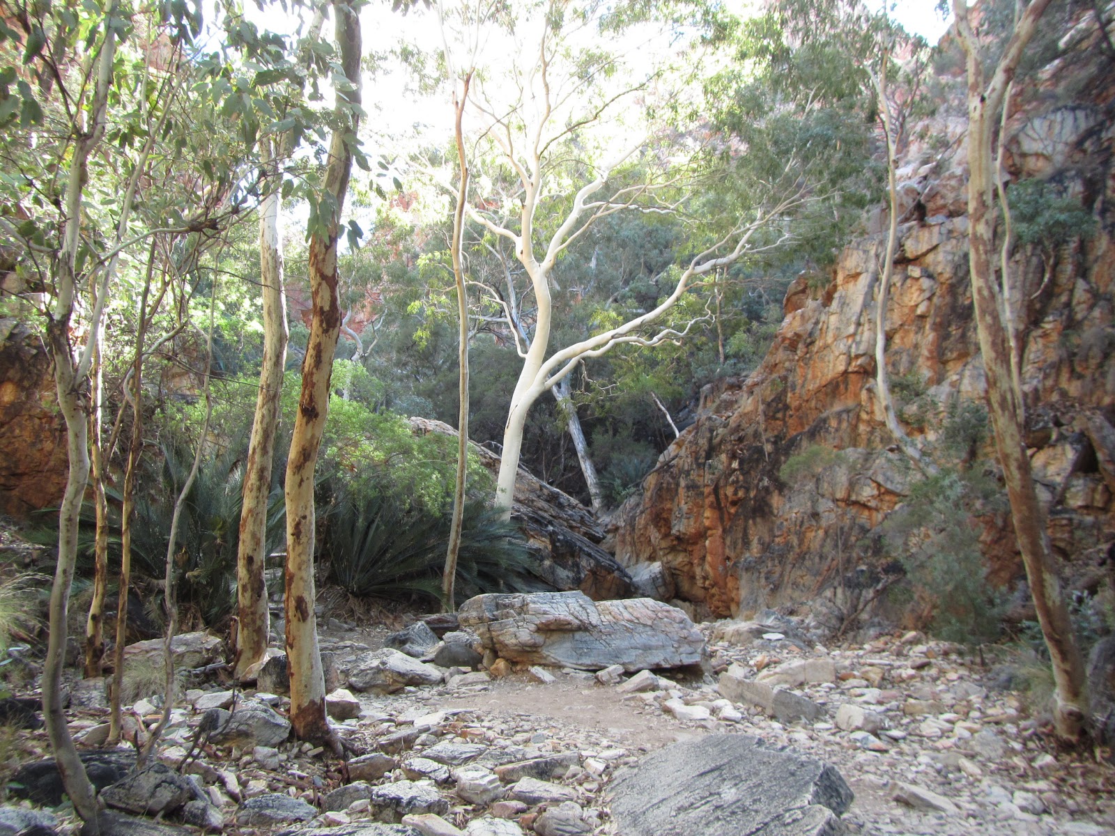
Inarlanga Pass has recently been opened to all walkers. Few YHA bushwalkers and I missed this section of the trail about a decade ago. Water in the gorge is excellent and I drink it without bothering to treat.
It is a great experience to go through Inarlanga Pass and I take time to explore it. There are many big boulders along the way and once I have to separate the pack and find ways to get through.
I arrive at camp early and settle in nicely near two water tanks. Other facilities include a new hydro loo and an information shelter. The campsite is located at the end of a 4WD, and so it provides access to day walkers who are interested in the climb up Counts Point


On leaving Pioneer Creek (L) and Approaching Inarlanga Pass (R)


Northern Inarlanga Pass (L) and Inarlanga Pass (R)


Serpentine Chalet Dam, my first campsite near water tanks
Sunday 23rd:
Walk from Serpentine Chalet Dam camp via Counts Point, and then descend Serpentine Gorge camp (Section 8).


Me at Counts Point junction (L) and Heavitree Range from Counts Point


Sunset on Macdonnell Ranges from Heavitree Range

Sunset over Serpentine Chalet Dam
After a short walk along the spur, the track takes me down to Serpentine Gorge camp, where I meet a couple
from WA. We have a chat. I tell them that I walked part of Biblement Track - from Wapole to Albany and they tell me that they completed the whole trail. It is getting dark and I need to get things organised and so apology for not being able to join
them for dinner as invited.
Monday 24:
Both neighbours and I are up early. While I still enjoy the warmth in the sleeping bag, they are doing the packing and when I am out for sunrise, they are already gone. The sunrise views of the area are fantastic, which are rather different from what seen in daylight. The start of today is a side trip to Serpentine Gorge and The Lookout and I would recommend it to all walkers including those going for an overnight or a day.


Sunrise over Serpentine Gorge


Sidetrip: Serpentine Gorge (1.4km) and The Lookout


Sperpentine Gorge waterhole and the lookout

Macdonnell Ranges from the lookout
Back to The LT junction with a signpost, I have a break with some sweets then shoulder the pack and head for Ellery Creek (Section 7) via Trig Point Spur, from which traffic on Red Centre Way can be in views. I arrive at the camping area in the late afternoon. After setting up tent on a sandy site then collecting food drop and water from a water tank, I quickly head to Ellery Creek Big Hole for a swim then walk back to camp and cook dinner with my head torche on.


Track along the base of Heavitree Range (L) and
Rock-hoppe along Trig Point spur
Rock-hoppe along Trig Point spur


Soft sand camping at Ellery Creek and a swim.
Tuesday 25th: Make an early visit to Ellery Creek Big Hole for photos. Because there is no bin around, I leave (clean) rubbish in the food container, that is provided by charter transport operator, then arrange camping fee of $5.00 before leaving for Rocky Gully Camp (Section 6). There are few caravans and 4WDs in the car park and camping area. Leaving the car park, I head east about 50m to get back to the trail, where a walk-in campsite can be found. Personally, I prefer this campsite to the one, in which I stayed last night. If you are a quiet person, then this is the one.


Ellery Creek Big Hole and The sandy creek bed campsite 2


Climb up a ridge and sidle into the saddle..(L)
then scramble down on a path filled with loose stones (R)


Alice Valley View (L) and Approaching Rocky Gully (R)
I arrive at camp before it rains and have a quick dinner under the tent fly. When it stops raining, I go out doing the washing (Aquium Gel, useful stuff) and leave them dry overnight on trees. There is a water tank and a new hydro loo at the campsite.
Wednesday 26th:
Rocky Gully Camp to Hugh Gorge (Section 6). Head back to the junction and continue on. It is a bit of rain in the evening.


Rocky Gully in the early morning (L) and Hugh Gorge from Hugh View (R)

Hugh Gorge Campsite
Thursday 27th:
Hugh Gorge to Hugh Gorge Junction and a side trip to Upper Hugh Gorge, and then through Rocky Saddle to Fringe Lily Creek (Section 5). Permanent small waterhole near camp.
Spend a bit of time looking for the trail. It is mainly to follow the creek bed into the gorge. Go over boulders until reaching Hugh Gorge junction, where a few tents can be pitched (unofficial). Take a side trip to upper gorge, then zig zag up to Rocky Saddle, where I meet a couple, then later a guided group, from whom I learn that "we have the new PM". This reminds of my contact and so I have no hesitation to send a text message telling where I am up to. There is no reception here and I am told to try it on Razorback Ridge. I arrive at camp early and go looking for the waterhole for drinking and cooking.


The creek bed at Hugh Gorge and Rocky Peaks


Hugh Gorge and Waterhole

Deep pool before Hugh Gorge junction
Sidetrip: Upper Hugh Gorge, 1.2km return


The northern end of the gorge


View back of Hugh Gorge on the climb up Rocky Saddle (L) and
Me on Rocky Saddle


Finge Lily Creek (L) and An intermittent waterhole near the campsite

Friday 28th:
Leave Fringe Lily Creek for Birthday Waterhole junction (Section 5) via Razorback Ridge, Rocky Talus and Spencer Gorge with water for drinking and cooking. Early morning I spend a bit of time on scouting for the trail head by retracing steps back to the trail. Then, I cross the creek and start the steep climb.


Climbing Razorback Ridge


Looking back to the ascent (L) and the descending Razorback Ridge (R)
The walk down Rocky Talus is rather steep and slow like the walk through the rocky Spencer Gorge. I pickup some water from a creek near the exit, then continue to Birthday Waterhole junction to camp


Rocky Talus

Spencer Gorge
Saturday 29th:
Early morning I take a walk to Birthday Waterhole (Section 4/5) mainly to collect 2 days supply of water for the climb and camp at Brinkley Bluff Summit (Section 4), and the walk to Standley Chasm (Section 4) the next day.
It is only less than 1 km from the junction to the official campsite and takes about 15 minutes one way. The walk is on soft sand along a dry creek bed and on a service track. There is a water tank at this official campsite, but there is no toilet.
Sidetrip: Birthday Waterhole 1.8km return


The sand-filled creek bed track and Birthday Waterhole campsite


Brinkley Bluff from Stuart's Pass (L) and Rocky Cleft (R)
The last bit is very steep. Thankfully, the trail is well-cut. This well-cut zig zag track like many other zig zags on the LT trail does ease the vertical climb. I arrive at the summit camp at 4.30pm, setup tent, then go exploring along the summit ridge. A young couple from Switzland arrive a bit later and a "shelter" tent site near the summit cairn is suggested to them. It is a very windy and freezing night.
The climb to Rocky Cleft is not too bad. It is ratrher a gradual zig zag climb.


Sunset on Brinkley Bluff Summit 1209m (L) and Western Bluff from tent (R)


Campsite and Sunrise over summit cairn from tent


View east (L)


Summit Cairn and View north


Early morning view of Mt Conway 1135m
After enjoying stunning sunrise views in the cold on the top, I pack up and leave camp for the walk along the ridge down Standley Chasm, where the third food drop is waiting for the collection and where I can buy a hamburger and have hot shower. Camping fee is $7 per night per person and a fee to get into Stanley Chasm is $8.
Sunday 30th:


View back of the descent from Brinkley Bluff and View east from Brinkley Bluff


View south from Reveal Saddle (L) and Hitting the road to Standley Chasm (R)
We meet again on my side trip to Telegraph Station near Alice Spring. I ask him about the young couple I met on Brinkley Bluff and he says that they are about 2 hours behind him.
Tuesday 1st, July:
Organize a lift back to Alice Springs, then do short walks around Standley Chasm. Meet again two walkers talked to at the carpark. One of them is a school teacher and is doing a school project. They are heading for Jay Creek. After checking out views from unofficial lookouts, i head back down the LT junction, then walk back to Standley Chasm for photos of the gorge lit-up at noon.
Early morning in Standley Chasm


Further in.

View east from a lookout near LT


Back down to Standley for noon light

Standley Chasm from LT

Standley Chasm lit-up at noon.

Kiosk, food drop service and hot shower for LT walkers

also sidetrip: Scenic Loop
Tuesday 2nd:
Travel back to Alice Springs and check into YHA, then return the food drop key to The Tourism Office.I am lucky to have a lift back to Alice Springs with a retired couple, who are from Endeavour Hill, east of Melbourne and have been travelling around Australia in their 4WD and caravan. They drive to Alice Springs for the internet and head back to Standley.
Wednesday 3rd:
Walk around Alice and consult with a chemist for insect bites cream (bed bugs).
Take a side trip to Telegraph Station. On the way, i meet the walker who shared the campsite with me at Standley Chasm and who is about to complete the entire Larapinta Trail from west to east. I am told that the couple I met at Brinkley Bluff are also on the way and about two hours behind him.

Sidetrip: Telegraph Station near Alice Springs


Trig Hill
Thursday 4th:
Return to Melbourne on Tiger Airways.Luckily, there was only me in the room last night and the decision of moving bed was helpful. The debug cream and tablets have worked reasonably well and i had some decent sleep unlike the night before of "turn and toss" due to unbearable itches.
At breakie, I share the same table with the couple i chatted to during dinner yesterday and give them some hints of places to visit and go for daywalks. The reduction of the hives on me are also noticed by them. When i am about to leave the communal kitchen to get back to the room for the packing, i meet again the couple i bumped into at Brinkley Bluff and learn that they spent the night at Telegraph Station.
It takes a while for the airport shuttle bus to reach Alice Springs Airport because it stops at pickup points such as hotels and backpackers where bookings could be arranged. If travelling in group of 3 or 4, taxi would be a better way. It works out almost the same cost.
While in queue waiting for check-in at the airport, passengers are reminded of the maximum of their luggage weight. Extra weight fee is applied. The check-in luggage and the carrying luggage are weight separately.
When getting home, I immediately go and see a local GP for cream and tablets and both work well.