

ParkVic's map with the marked route taken on the trip
On Friday, it took us about 10 minutes to locate the start of the Moroka Gorge walk with a sign post and an intention book. The walk starts with a pad leading through attractive bushland to the first waterfalls and ending at Lummican Gully.

SVmaps, Horseyard Flat to Waterfalls

Foot pad near the start
We met a family of four on
the track and they were on their way back to the campground. We were told that there was a brown snake
near the track just before the waterfalls and about 150 metres away. We never saw it!
We had a lunch stop at the
first waterfalls, at which we met two overnight walkers, who also
stopped here for lunch. From here, the
track became rough (and slippery when wet).

Lunch spot

First falls in the Moroka Gorge
Just before the Lummican Gully,
we met two day walkers, who were walking in the opposite direction to us and warned us of a black
snake which was spotted at the Lummican Gully campsite.

Me at a view point near the track
On arrival at the Lummican Gully
camp, we found that the track was no longer a track. Here, we and the two
walkers we met at the waterfalls, faced the same problem to locate the route
into the gorge: the high route or the one along the river bank. The high route was rough steep and scrubby. The low route seemed to be blocked by the high river and boulders.

View down stream from Lummican Gully campsite
From my memory of a trip with
YHA bushwalkers over a decade ago, when the high route had been tackled, I
determined to take the high route with the use of a GPS and a compass. The aim was to head northwest to the
junction of the river and Kent Creek, the start of the second day in the
initial walk plan. It was rather slow
going on the rough ridge and we had one or two stops to check location.
It took about 20 minutes to find a reasonably safe access down to the
river. A GPS waypoint was marked here just in case it was needed for the return trip.


The fallen log on the right river bank, where we came down from the high route
Once we reached the river bank, we rock hopped and scrambled about 100 metres along the rocky river bank to the second falls with a lookout which provided good views of the river gorge and cliffs.
Knowing that we were not far
from the turnoff to the third waterfalls, and also the access up Dawson plateau
and Snowy Bluff, we left our packs here and started looking for a campsite and
exploring the river and route conditions for the next day. A challenging access was chosen for investigation and we found two ways to get down the cliffs without the use of
rope. The water level seemed reasonable and looked "do-able" in late
afternoon. We had no luck to find a
better campsite than the one where we left our packs; therefore, we decided to
pitch tent up there on the rock on the top of the cliffs.

Me at second waterfalls
Good views from our camp
We had tuna,
coucous, and pudding for dinner. After the meal, Allan had fun with fishing and one brown trout was unlucky to get caught but it was quickly set free after being posed for the camera. A bit later we were surprised by a platypus
which was zig zagging in front of us along broken rocks to get into the
river. An amazing experience!


Kent Creek and the third falls
 SVmaps, Shanty Hollow to Snowy Bluff plan was abandoned

We continued further downstream for about 100 metres and were delighted with
the view of the fourth falls.


There is a cliff
at the bend and the river was high; so, Allan did not want to go
on. With care I walked over the cliff to get onto the other side of the river, explored a bit around there, then came back.


Gateway to the lower falls, the fifth and we missed it!
Here, we again met the two overnight walkers. They had spent an overnight at Lummican Gully and took the low route
in this morning. Like us, they
abandoned their plan to go to Dawson Plateau and Snowy Bluff.
We spent the afternoon on fly-fishing and checking out the river bank for the walkout tomorrow
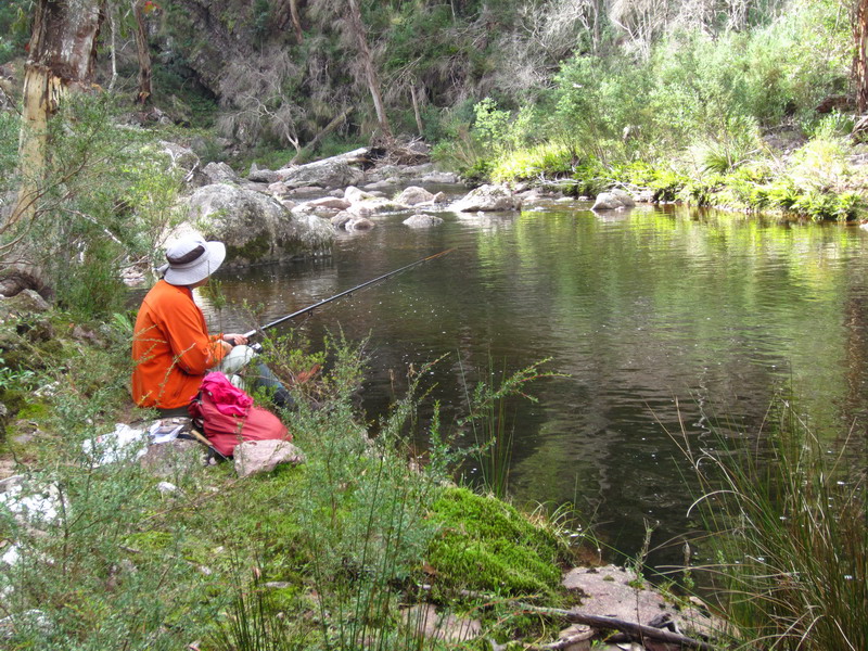
Fishing near Lummican Gully

If you look closely ...
With the forecast of rain for the following afternoon, from a very poorly received radio station, we arose early the next morning, trying to get past the steep and slippery
section of the track before the change in the weather.


Light rain started to fall while we were having lunch on the steps near the first falls and it steadily increased during the afternoon and turned to sleet as we approached the waiting car at the campground.

As we drove home over the McFarlane Saddle, the sleet turned into snow providing a "winter wonderland" end to the trip


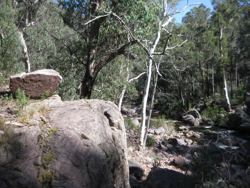
Boulders near Lummican Gully

Cliffs near Lummican Gully

The forecast was right as we were in rain jackets

Bush land near Horseyard Flat


McFarlane Saddle, the start/end of Tali Karng's 16 river crossing walk