02 November 2012

Mt Bogong Circuit

Topographical map with the route marked in grey

We arrived at the Mountain Creek picnic and camp area just before it got dark. There were two or three cars that had arrived before us and we had a visit from a nearby camper.  A few cars arrived a little later, during the night.

The walking track signposts can be seen in the picnic and camping area and the Mt Bogong track signpost is located to the east of the visitor information board and this tells us that is two kms to the base of The Staircase and eight kms to Mt Bogong.

Generally speaking, the walk up to Mt Bogong via Eskdale Spur is less steep uphill than the Staircase, but the walk to Eskdale Spur on Mountain Creek road is rather long. We chose to walk up the Staircase Spur and walk down Eskdale Spur, based on the weather forecast and Allan’s wishes (ok on ups and not very ok on downs).  Unlike Allan, I am rather slow at ups specially if loaded with gear and days of food.
 

The walk from the camp area to the base of The Staircase is less than 2 kms on a gravel 4WD road and a walker’s intention book can be found just beyond the start of the Staircase Track.  It’s useful for the park rangers to know your walk plan and vehicle rego so that a search party can be sent in the case that a walker fails to return on time.

 
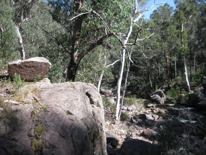
 One of a few creek crossings before the base of the Staircase

The foot track from the base of The Staircase to Mt Bogong can be divided into 3 sections:

The start of The Staircase – Bivouac refuge: about 3 kms 
It is a steep long walk up to the hut which is located on top of an open spur and it's there for emergencies. There are few good tent sites on the eastern side of the hut. If starting the walk late, this would be an ideal for spending the first night (as we did!). Just a note to myself; tell Park and Wildlife that the tank tap needs repairing.

Bivouac Hut

Bivouac refuge – the start of a pole line: about 1.5 kms
The track continues on behind the hut. It was a nice and pleasant walk upwards, skirting around a rocky spur above the tree line. The views at this point was amazing with the ranges to the north, Eskdale Spur to the east and Little Bogong to the west.

Final climb: about 1.5 kms
Follow the pole line uphill on the open spur for about 700 m, then pass a monument where three skiers died during a heavy snow storm in 1943. Fine weather can offer stunning views of Mt Bogong to the south, and West Peak to the west. When the crest of the ridge is reached, most of the hard work have been done. Mt Bogong summit,1986m, the highest peak in Victoria is an easy 100m walk to the west.


 The pole line on the Staircase Spur

View of Mt Bogong from the monument

Packs were left here for a side trip to the summit cairn and West Peak; but we only got to Hooker Plateau and returned.  While I was keen on heading to Bogong Creek, to check out the availability of water (Original plan was to camp here on first day), Allan did not want to go further because we didn’t have gear with us.

Me on the summit cairn

Back at the summit cairn we took a couple of photos, then headed back to the junction to reunite with our packs, then found a sheltered spot from the sun and the wind for a late lunch, near Hell Gap, with views down spurs to the south and southwest.  After lunch, we followed a foot track as a short cut to the pole line route, then southeast to our destination, Cleve Cole Hut in Camp Valley. It is a pleasant three kilometre walk on the high plain with 360*views and in particular of Mt Bogong to the west, Quartz Ridge & The Grey Hills to the southwest, and Mt Feathertop further on. 

 Mt Bogong from Hell Gap


Late afternoon view of the southeast where I spent a couple of days on Australian Alps Walking Track (AAWT) with some Melbourne Bushwalkers some years ago (Thanks Max).

 Falls Creek Area where we spent 3 days on skiing in September this year

The arrival at Cleve Cole Hut was in good time. The hut has good facilities for skiers and can accommodate four in emergencies, for those who wish an escape from wild weather. The area is surrounded with gum trees which provide many nice and sheltered camping spots.

Loo with a view!    

Mobile phone coverage from Fallscreek was quite good. The plan to make a visit to Howman Falls the next morning was cancelled due to strong winds, storm and rain forecast. The packing was done in tent and most walkers cooked and had their brekkies in the hut. It was very windy on the way back to Hell Gap where we tried to locate Eskdale Point/Spur to go down. 

Eskdale Point/Spur

The snow poles on the open ridge were useful to identify the spur. On the way down, we met and spoke with two Park staff who were at work and on their way up. One of them carried a compact and light-weight chain saw and there was evidence of track clearing on our way down. Damn! forgot to let them know about the leakage of water tank tap.

Allan's eyes on The Staircase

The first 1.5 kms of the spur is rather steep and slow going. Its on a gravel zig zag foot path and care should be taken. It is very exposed and so it was bleak on this windy day. On a clear day, there are good views of Mt Bogong to the west and The Staircase to the northwest and again the whole northeast including Mt Kosciuszko.  

A rough and rocky foot pad on Eskdale Spur

We stopped for lunch near the junction of Eskdale Spur and Granite Flat Spur, about 200m to Michell refuge, a newly-built hut to replace the old one which was burnt in 2003 fire. There are very limited tent sites available at the hut; but there are lots of opportunities to camp in the bush near the hut. The Camp Creek Gap, which is located at the junction of Mountain Creek Road and Mountain Creek Walking Track, can provide an alternative. 

Southeastern views

Mt Bogong from Michell Hut 

On reaching Mountain Creek Road, we took Mountain Creek walking track to avoid a short steep climb and a detour  Similarly, we took the Black Cockatoo and Tree Fern walking tracks to avoid walking along the road. 

 Mountain Creek Walking Track

 
Tree Fern Walking Track

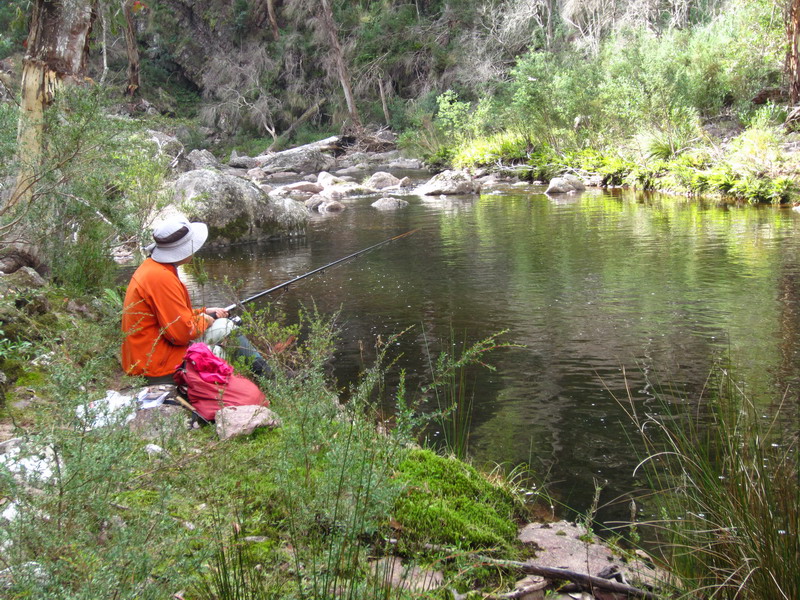
Towards the end of the walk, I looked forward to a skinny dip at Mountain Creek before the long drive home.

10 September 2012

Falls Creek Winter Ski

It was a rather good snow season last year and we were very lucky to book into a ski lodge after a check on weather forecast.  Our friend is a long-term member of the club, and my friend is a regular guest; therefore, I could come along.  It is quiet and less crowded in mid week. 

It takes about five hours from Melbourne to travel to the gateway to the alpine resort.  We arrived at the gate at 1.45pm and we discovered afterwards that we could have saved a day of parking fees by arrival after 2.00 pm  Such a nice ticket lady!  For those, who don’t want any hassle and/or fees related to the drive-in, cars can be left at the carpark at Mt Beauty where there are Falls Creek coaches to take passengers and gear to the resort.  

The High Plains Road from Mt Beauty to the gate at Falls Creek resort is quite winding.  We both enjoyed the views along the way and it took around about an hour to get to the oversnow station from Mt Beauty.  The oversnow station was rather busy with people leaving after the weekend and new arrivals like us.  The oversnow shuttles were useful and there were about 6 people including us on board.  We were dropped off and picked up at the lodge, together with our ski gear and foodbox.  .  We were earlier than the lodge check-in time, so had a cuppa and waited for a little while.  There were about four or five including us at the club house that night and our friend Steve joined us the next day. 
Early morning, we could ski out from the front door to the ski trail.  We spent two days on down hill skiing (my first DH activity) and one day of XC taking in the Aqueduct, Heathy Spur, Langsford Gap, and back.

Love the lodge with its hot showers and drying facilities.  Did not have to put on wet socks and clothes the next morning.  There were good views of  Spion Kopje Spur from the balcony and the windows.

Below is the link to maps of the alpine resort and ski trails.  Trip photos are also included
 Falls Creek village and trail maps

 My first down-hill skiing

Ropers from Dam wall

Rocky Valley Storage

Me on Heathy Spur XC ski trail

Allan and snow

Near the junction of Heathy Spur and High Plains Road

18 August 2012

Pyrenees Pack Carry, Eastern Range


Waterfalls Picnic Ground to Cameron Track Camp 

The Pyrenees Range is about 200kms northwest of Melbourne and about two and a half hours drive. The closest town is Avoca located east of the start of the walk at Waterfalls picnic area that is easily travelled in 2WD in10 minutes. 


Did it solo as an overnight walk due to no car shuffle. Pyrenees Endurance walk continues on from Cameron tk campground about 10kms further to be finished at Glenlofty-Warrenmang Rd / Hankin Tk Junctiion (see additional info below).

A walking track post can be found at Waterfalls picnic car park, just after the bridge and about 10ms further, Pyrenees Endurance post with the information of the walk 21km, One way.

The walk starts with a steep climb to the top of the range. It would be slippery if wet and a trekking pole would come in handy specially for the return trip. The trail from the start through Main Break to Mt Avoca (featured with a trig, 747m), through Emery Tk, then linked up with Old Tiger Cat Tk, is well-marked and maintained. Turn right at Old Tiger Cat, head West for about half of km and take notice of an unofficial marker with stones on the right (position 706278, 5891324). From here, there are a couple of options to get down to Nowhere Creek and Pyrenees Endurance Trail junction:


1) keep following the (walking) & bike tk heading West down and down about 350m to Nowhere Creek at a hairpin. Ignore the foot pad on the other side of the creek, instead continue on a short distance to reach the junction at a walking track post (position 705834, 5891353).

This signpost was missed on day one. I crossed the creek and followed the foot pad (see topo map file, reach pwt from crk) because of trying to avoid the eroded bike trail.

2) Go west, xc down to Nowhere Crk. The timbered forests here are open and so the opportunity arises. If doing so, you may come across parts of Pyrenees Endurance Zig Zag Track. Here is another useful post at the trail & crk junction (postion 705987, 5891503 & photo attached)


3) The start of the zig zag track should be close to where the stones marker is. It was missed on day one, too.

When reaching the Pyrenees Endurance post/s on the bank of Nowhere Crk, leave the creek and follow the track up. One or two orange triangles can be seen on the way. Ignore blue ribbons, continue on West until the sight of the next orange triangle (Reach pwt). From this point, only a short section on a track was the “tks” -“Reach tk, d2”


 Cameron Track Camp Shelter

Below is the atachement of the topo graphical map file with the route and useful GPS way-points taken from Old Tiger Cat Tk to Cameron Tk Campground. As discussed on the well-defined track from Waterfalls picnic to Old Tiger Cat Tk, I don’ t see the need of another topo file. The entire route can be found on Parkvic map; but neither on the topographical maps 1:25k and 1:50k (2006) I have, nor on the online Mud map. 


My final words for those planning to do the walk are: Be well-equipped with a proper topographical map & a compass (GPS optional), start early and carefully observe the orange triangle markers. 

Related information

ParkVic map of Pyrenees, Western Range

Pyrenees Range, Scale 50k by Spatial Vision Map, Edition 2006

13 May 2012

Autumn Leaves Stroll

Have a few photos from a short stroll in the Dandenongs on Sunday. The autumn leaves are stunning and it is still ok to go and see. But, don't forget to check this out early May next year.

Dandenong Range NPs - Sherbrooke


06 April 2012

Moroka Gorge over the long weekend

We arrived at Horseyard Flat campground on Thursday 5th April early enough to find a nice grassy spot.  Good tent-sites along the river had already been occupied by campers and day walkers. 
 ParkVic's map with the marked route taken on the trip

On Friday, it took us about 10 minutes to locate the start of the Moroka Gorge walk with a sign post and an intention book.  The walk starts with a pad leading through attractive bushland to the first waterfalls and ending at Lummican Gully.  

 SVmaps, Horseyard Flat to Waterfalls

 Foot pad near the start

We met a family of four on the track and they were on their way back to the campground.  We were told that there was a brown snake near the track just before the waterfalls and about 150 metres away.  We never saw it!

We had a lunch stop at the first waterfalls, at which we met two overnight walkers, who also stopped here for lunch.  From here, the track became rough (and slippery when wet).

Lunch spot

 First falls in the Moroka Gorge

Just before the Lummican Gully, we met two day walkers, who were walking in the opposite direction to us and warned us of a black snake which was spotted at the Lummican Gully campsite.

Me at a view point near the track

On arrival at the Lummican Gully camp, we found that the track was no longer a track.  Here, we and the two walkers we met at the waterfalls, faced the same problem to locate the route into the gorge: the high route or the one along the river bank.  The high route was rough steep and scrubby.  The low route seemed to be blocked by the high river and boulders.

 View down stream from Lummican Gully campsite

From my memory of a trip with YHA bushwalkers over a decade ago, when the high route had been tackled, I determined to take the high route with the use of a GPS and a compass.  The aim was to head northwest to the junction of the river and Kent Creek, the start of the second day in the initial walk plan.  It was rather slow going on the rough ridge and we had one or two stops to check location.  It took about 20 minutes to find a reasonably safe access down to the river.  A GPS waypoint was marked here just in case it was needed for the return trip.

The fallen log on the right river bank, where we came down from the high route

Once we reached the river bank, we rock hopped and scrambled about 100 metres along the rocky river bank to the second falls with a lookout which provided good views of the river gorge and cliffs.  

Knowing that we were not far from the turnoff to the third waterfalls, and also the access up Dawson plateau and Snowy Bluff, we left our packs here and started looking for a campsite and exploring the river and route conditions for the next day.  A challenging access was chosen for investigation and we found two ways to get down the cliffs without the use of rope. The water level seemed reasonable and looked "do-able" in late afternoon.  We had no luck to find a better campsite than the one where we left our packs; therefore, we decided to pitch tent up there on the rock on the top of the cliffs.

 Me at second waterfalls

Good views from our camp 

We had tuna, coucous, and pudding for dinner.  After the meal, Allan had fun with fishing and one brown trout was unlucky to get caught but it was quickly set free after being posed for the camera.  A bit later we were surprised by a platypus which was zig zagging in front of us along broken rocks to get into the river.  An amazing experience!   

It was so peaceful here, apart from the sounds from the waterfalls flowing in full strength and the high winds during the nights.

 The unlucky brown trout!

On Saturday morning, the river was a bit high and fast flowing and Allan was not keen on a river crossing; therefore, our plan to go to Dawson Range, one of the routes up Snowy Bluff was cancelled.  We could see the third waterfalls from the junction and so there was no need to cross the river.


Kent Creek and the third falls

 SVmaps, Shanty Hollow to Snowy Bluff plan was abandoned
We continued further downstream for about 100 metres and were delighted with the view of the fourth falls.


The fourth falls 

There is a cliff at the bend and the river was high; so, Allan did not want to go on.  With care I walked over the cliff to get onto the other side of the river, explored a bit around there, then came back.

 Gateway to the lower falls, the fifth and we missed it!

Here, we again met the two overnight walkers.  They had spent an overnight at Lummican Gully and took the low route in this morning.  Like us, they abandoned their plan to go to Dawson Plateau and Snowy Bluff.

We spent the afternoon on fly-fishing and checking out the river bank for the walkout tomorrow

Fishing near Lummican Gully

If you look closely ...

With the forecast of rain for the following afternoon, from a very poorly received radio station,  we arose early the next morning, trying to get past the steep and slippery section of the track before the change in the weather.  

 Boulders near Lummican Gully

Cliffs near Lummican Gully

The forecast was right as we were in rain jackets

Light rain started to fall while we were having lunch on the steps near the first falls and it steadily increased during the afternoon and turned to sleet as we approached the waiting car at the campground.  

 Bush land near Horseyard Flat

As we drove home over the McFarlane Saddle, the sleet turned into snow providing a "winter wonderland" end to the trip


McFarlane Saddle, the start/end of Tali Karng's 16 river crossing walk