
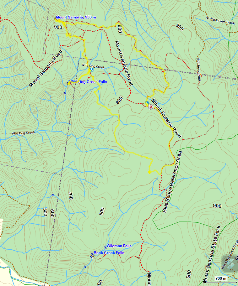
Mt Samaria State Park is located in northeastern Victoria and it is about 210 km from the Melbourne CBD. The closest town is Mansfield. The park offers a variety of activities such as walking, camping, picnicking and 4-wheel driving.
To get there from Mansfield, travel 14 km north via Whitfield Road (C521), Blue Range Road and Mt Samaria Road. The gravel road past Blue Range Creek Campground is steep and rocky, but is accessible to all vehicles, in dry condition.
Back Creek Falls
It was in the afternoon when we drove past Rocky Point Lookout and it was getting dark very early and so we did not stop. We travelled a further 2 km north along Mt Samaria Rd to reach Back Creek Falls car park. It was only a short walk to the falls so we had a quick bite to eat and a sip of coffee and headed to the falls.
The plan to camp at Camphora Campsite (2.9 km one way) and to walk to the falls from there was abandoned because we did not have enough time.

The Camphora Campsite has been redesigned as a Walk-In Campsite with a carpark about 100 m away and so we drove to the Spring Creek campground . It was nearly dark and we quickly pitched tent, had dinner, spent a bit of time discussing the start of tomorrow's walk and then retired to bed.
In the morning, after packing for an overnight walk, we had a good look at the Park Map Information Board and decided to stick to our initial plan to walk via Camphora Camp to Wild Dog Creek Camp.
We left Spring Creek Campsite and walked back to Camphora Walk-In Campsite via Mt Samaria Road. It was about 2.5 km of gentle down hill walking.

The Camphora Walk-In Campsite with a table and a drop loo. BYO water.
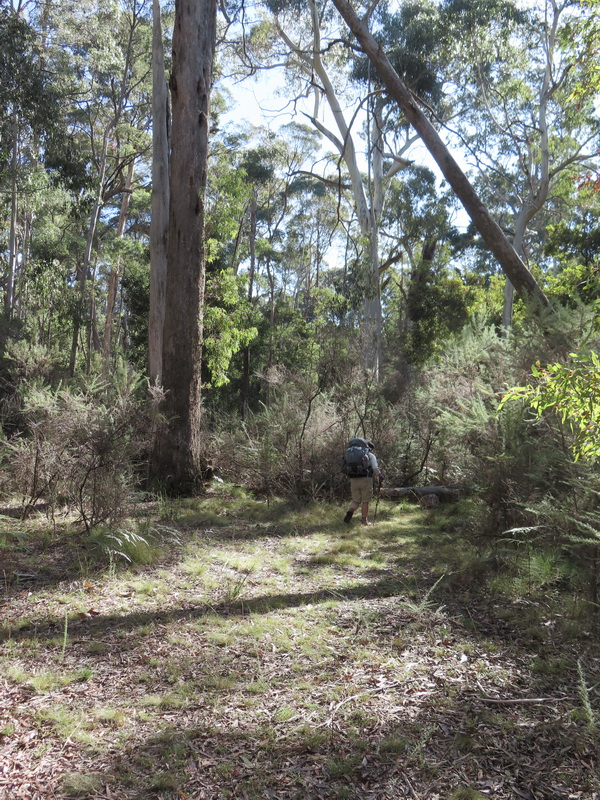
Leaving Camphora Camp for the next camp.
Camphora Camp to Wild dog Creek Camp: 3.3 km, 1 hr 30m
The track is well-defined and easy to follow. There were many trees down across the track but it was manageable. There were a few rather large trees and we had to climb over and/or to get around them. We took our time because each of us were carrying about 16 kg weight including 3.5 litres of water (for drink on the track and for cooking dinner and breakie).
We arrived at the Wild dog Campsite early enough, as planned. After snacks and a cuppa we set off with a light pack for a visit to Wild Dog Creek Falls which was about 900 m away. The path to the falls was well-marked. The decent to the falls was rocky, steep and assisted with steps that lead to a viewing platform.

Mt Samaria from the viewing platform (see you tomorrow)


My light-weight hiking chair and Allan's new light-weight tent and pack/s.
This was the second time that the tent had been used and there was no problem with pitching the tent. It took only few minutes to put it up. I did not know that we would have the luxury of a camp table and chairs at the camp, so I had carried the hiking chair and so I had to use it.

Wild Dog Creek Falls
Thankfully I was able to view the waterfalls this time. Without the viewing platform at the falls I had not been able to get close to it some years ago.
Wild Dog Creek Falls Walk-In Camp to Mt Samaria Summit
Early morning when we left the camp and approached Wild Dog Creek, I was surprised to see a reasonable amount of water in the creek. It had been bone dry on my last trip. Each of us had carried an extra 2 litres for cooking the dinner and for the breakfast.


It was a gentle climb after leaving the creek. There were just a couple of trees down on this track. After 1 km we crossed the Mt Samaria Road and the track became rather steep. After a further 0.8 km we reached the junction of the short summit circuit track. This waypoint would be useful for the return loop for day walkers who start from Mt Samaria Rd. A further climb of 30 m took us to another junction with the summit track for those who walk up from Mt Samaria Rd in the southwest. From this junction, we could see Mt Samaria trig just about 25 m away.


Mt Samaria Summit, 953 m
After a lunch with the view and a lot of photographs, we said good bye to Mt Samaria. We headed back to the sign post showing the way back to a carpark. Following the path for about 15 m, we lost the track and so we back-tracked to the sign post, pulled out our navigation gear such as the GPS with the preloaded route (from Alltrails website) and the compass. For just-in-case-of-emergency, a mobile phone with a preloaded off-line map (for hiking/bushwalking ..) can be useful. We knew that we were heading in the right direction and the track could not be far away. It was just about 20 m northeast from us. It took about 10 minutes for us to find the correct track marked by an orange triangle nailed on the tree, the first marker we had seen after leaving the summit.
Note: There were the three paths leading off Samaria summit.
We were trying to take the north most path.
The walk down 1 km to the junction with a path to the Mt Samaria Rd (for day walkers) was pleasant. Route finding skills and a compass bearing was required. We continued on heading east and stopped on a knoll for lunch and with extra water we boiled water for soup.
From here, the path was less well-defined and care must be taken. It was easy to lose the track and not easy to get back on. After 0.5 km walk the track became steep. Blue Range is a little higher than Mt Samaria and we had a stop for a rest break. We walked past the Butchers Tk junction and reached Rocky Knob, the highest point on the top of the Blue Range, where we discovered a geocache hidden near the top.


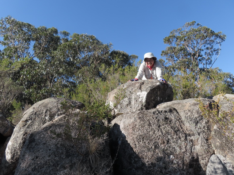
Blue Range, 974 m


The next day we decided to continue along the Mt Samaria Road to Williams Road via a lookout over Lake Nillahcootie and the Strathbogie Ranges. The first part of Williams Road is only suitable for 4WD and AWD vehicles


