Showing posts with label wildflowers. Show all posts

20 December 2015

Tali-Karng and nearby


I felt rather unfit because I have not done any pack-carrying walks for a while.  This was a warm-up walk for future longer walks planned for Tasmania early next year.  Lake Tali-Karng is located in the Avon Wilderness area of Victoria and north of Licola. 

The best time to hike is between November and April and this area has excellent alpine wild flowers in mid-to-late Spring.

Licola is approximately 4 hours drive from Melbourne through Traralgon and the start at McFarlane Saddle on the Moroka Rd is about a further 30 minutes from Licola (last petrol service).

The facilities at the McFarlane Saddle campsite include only a long drop loo and cleared campsites of varying sizes.

Park Victoria website suggests that you camp at Nyimba Camp and do a day trip to Lake Tali-Karng rather than camping on the shore of the lake.  This makes the descent to and ascent from the lake much easier as the access is very steep.  Also, the traditional owners of the lake prefer that people do not camp there and that visitors minimise their damage to a sensitive and sacret environment.

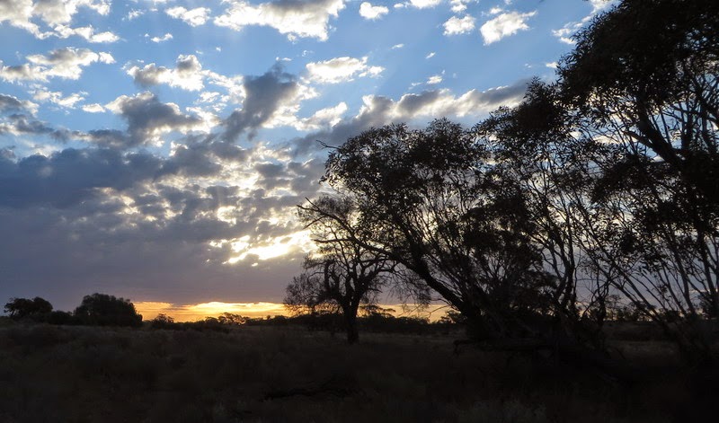
The walk from McFarlane’s Saddle to Nyimba Camp and Riggall Old Hut site across the Wellington Plain is approx 9km on a gentle gradient and it takes around three and a half hours including a long break for lunch.  The terrain is mostly alpine plain with occasional clumps of snowgums.  The larger snowgums are dead from the recent bush fire leaving only scrubby regrowth.
 Wellington Plain
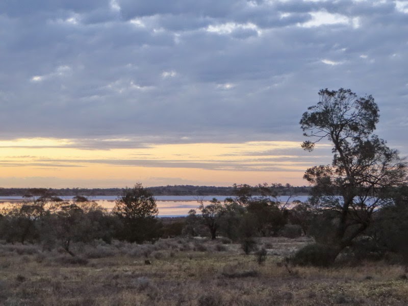
The Nyimba Camp has a lot of campsites and a long drop loo with a 600 litres rain water tank and a flowing stream.
Nyimba Camp
There are 2 possible routes to the lake from Nyimba Camp.  Gillio’s foot track is about 4.5km and steep with multiple zig-zags to help the walker down the steeper parts of the walk.  The easy-graded Riggall Spur and Echo Point Tracks are a little longer, but less steep.
Routes to the lake
We took the Riggall Spur and Echo Point Tracks to walk down to the lake and Gillio’s Track back climbing almost 600m (take about 3 hrs), but, in retrospect, it would have been better to have taken the other direction. 

There are several campsites and beaches on the western lakeside.  Tali Karng is a fuel stove area and no fires are permitted within 1km from the lake.  There are no toilet facilities at the lake.  The southern shore offers access to the Snowden Falls at the eastern end of the lake, if the lake’s water level is low enough.
Looking east (L) and the Snowden Falls (R)
The scramble along the rocky shoreline to the falls is worth the trouble to see a very spectacular medium size waterfall.  YouTube clip of the Snowden Falls
 
GPS tracks overlaid on VicMap memo-map Topo
Mt Reynard

There is a short half day walk from Howitt Road to the top of Mt Reynard with a height of 1710m.  The shortest access route to the summit is across a small wooden foot bridge with a clearly visible from the Howitt road shortly after passing the Kelly Lane turn-off while heading north.

After crossing the bridge, you proceed due west climbing up a grassy slope and then bush bashing through medium height scrub to the top of Mt Reynard.
The foot bridge (L) and Mt Reynard top (R)
The summit is found by walking to the highest point.  There is no view at the top; but there are good views of the valley on the way up. 

16 December 2014

Sheoak Creek & Lower Cumberland Circuit

Lorne Waterfalls - Walk Three
Lower and Upper Kalimna Falls, and Cumberland Falls 

Length: 15.4km,  Time: 5hours,  Type: Loop
Max Elevation: 295m,  Grade: Easy – Medium

Start and finish at the Sheoak Picnic Area on the Garvey Track, which is a park management track. Follow the Kalimna Falls sign at the east end of the picnic ground.  The Kalimna Falls track crosses the Garvey Track and then you can follow either of the two tracks along either side of Sheoak Creek to the Lower Kalimna Falls (2.9km) and the Upper Kalimna Falls (4.1km), then back track to a link track, which takes you across Little Sheoak Creek back to the Garvey Track.  Then, walk 1.2km east-north-east along The Garvey Track to the Cumberland River turn off.

The path to the Cumberland River is 1.5km and steep at the river end of the track.  At the river, turn right following the track along the Cumberland River about 400m to the falls.  There is a river crossing before reaching the falls.  Then retrace your steps back to the Garvey Track and continue down the track back to the start.  There is an alternative route back to the picnic area on the Castle Rock access track. 

The start                             Lower Kalimna Falls

Upper Kalimna Falls                                Sheoak Creek

 
Cumberland River Track & Falls
 
GPS route on GE
and
(Lorne Waterfalls - Walk Three)


(Lorne Waterfalls - Walk One)

14 December 2014

Lorne Waterfalls - Walk Two

Henderson Falls, The Canyon, Phantom Falls, and Won Wondah Falls 

Length: 8.15km,  Time: 3hours+,  Type: Return
Grade:  Easy
Maximum elevation:  202m

Start and finish at the Sheoak Picnic Area, which is located at Allenvale Road end, southwest of Lorne.  Follow the signposts to Henderson Falls, then return to the turn off to The Canyon and Phantom Falls.  On the return journey from Phantom Falls, the Won Wondah Falls can be viewed from a viewing platform, which is on a short side track off the main track back to the start.

                                    Henderson Falls
  
Wildflowers

                             The Canyon and Phantom Falls                                

Route on GE, and
A 4 minute video YouTube of Lorne Waterfalls - Walk Two 

 Back to  Erskine & Cora Lynn Valleys Circuit
(Lorne Waterfalls - Walk One)
(Lorne Waterfalls - Walk Three)

12 December 2014

Erskine & Cora Lynn Valleys Circuit

Lorne Waterfalls - Walk One
 
Length: 22km
Duration: 6 -7 hours
Grade: Medium
Elevation: 433m
Style: Walking track with many river & creek crossings over stones
Start/Finish: Lorne
Melbourne: 140km
Best time: Late winter & early spring (when the waterfalls flow at their best)

Track & map info: Walks & Waterfalls, Surfcoast Shire.
Topographic map: optional.
Erskine River Track and Cora Lynn Creek Track are well marked.

The walk starts from Kia Ora Caravan Park, which is located opposite to the Lorne Visitor Centre.  The entrance is on Erskine Avenue and there is Parks Victoria signpost showing the 7km length of the Erskine River walking track.

There is no doubt that this track is popular because of the starting point in the Lorne township, the attractive waterfalls and the wild Erskine River and gorge.  The path winds through the Erskine Valley, which is filled with tall trees and ferns.  It follows the river upstream and there are some river crossings.  The track passes The Rapids, Splitter Falls, Straw Falls and finishes at the base of the Erskine Falls, 300m past Straw Falls.  Erskine Falls is one of the highest and most attractive waterfalls in the Otways, Victoria.

After having fun with the camera and a chat with tourists at the Erskine Falls, we had a steep climb up steps, which led to the car park, where there is a signpost to Blanket Leaf Picnic Area.  This is the start of the 3km track, which links the Erskine Valley to the Cora Lynn Valley and saves about 3kms of road walking.  A big thank you.

On reaching the Erskine Falls Rd, cross the road to get to the start of the Cora Lynn Creek Track.  Then, a short gentle descent goes past a hike-in campsite and leads to the Cora Lynn Cascades.  From here, the track goes through a beautiful narrow gorge and the creek that feeds the cascades, is crossed many times before reaching Cora Lynn car park.  After checking out the map from the “Walks & Waterfalls” brochure, we followed the road SSE out to Green Break Tk, turned right and walked down to Allenvale Rd, and then turned left onto Otway St to get back to the start in Lorne.

 Erskine Valley (L)         At the base of Erskine Falls (R)

Cora Lynn Cascades

Erskine & Cora Lynn Valleys Circuit Walk
and
A video YouTube of the waterfalls in the valleys

It was rather a long day to do this two valleys circuit and I would suggest an early start to take it all in especially when days are short.  We ended up having a late dinner at “Chopsticks” restaurant in town.  Wear comfortable walking boots and avoid this walk after heavy rain, when the tracks and rocks become muddy and very slippery.  This walk can be done as an overnight hike using the walk-in campsite, which is located below the Blanket Leaf Picnic Area.  Moreover, with a few hike-in campsites and many other waterfalls walks nearby, it is also possible to have an extended hike of 3 to 4 days in the area.


(Lorne Waterfalls - Walk Three)

07 October 2014

Pink Lakes