
Lysterfield Hills
Length: 15.3 km, loop
Moving Time: 4 hrs+ for two hikers over 60s
Grade: Medium
Closest Town: Dandenong 13km
Location: Lysterfield Lake Park. Entrance is on Horswood Road via Belgrave - Hallam Road (C404) and opens from Sunrise to Sunset.
Facilities: Car park, lawn area, BBQ, toilets.. Bins are not provided, so take your rubbish home with you.
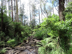
From the main car park, follow the path south to the beach picnic area near the dam and cross the dam wall from which there are good views.


GPS route of the walk and The lake view taken from the dam wall
On the far side of the dam we made a mistake, left the main walking track and took the Snipe Track, a mountain bike track. If we continued on further on the main track for 200m, we would have reached the well-signed start of the Granite Peak Trail (Tramline Track in Chapman's Day Walks -Victoria). We saw it on the return walk via the Acatia Nature Trail. It was not a technical mistake because the mountain bike track is not far and just paralell to the Granite Peak Trail. I made a compass check before we decided to follow it. There were some complaints from one or two riders those who liked speeding. It was forturnate that the park was reasonably open and so offered us the opportunity to bush bash to a junction where we had lunch and checked out our location, finding that we were close to Hallam North Road Carpark on Glen Track.
From the carpark (with toilets) we followed Valley View Track past Grasy Spur Walk and continued
northwest about 0.5km until we reached the junction of Lysterfield Hills Track (L) and Quarry Track (R). From here it was a gentle uphill walk for lesss than 1km to the Trig Point Lookout which was well worth the effort.


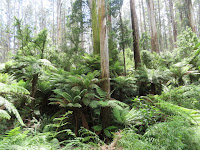
On the return we followed the Granite Peak Trail and turned left at Cloverdale Track, then walked about 100m and just after crossing the Casuarina Track, we turned right onto Acatia Nature Trail and walked south about 1.5km in order to meet Casuarina Track, where the start of the Granite Peak Trail track could be seen on the other side. Continued on south 200m, we passed Snipe Track, the start of bike trails.
From here we retraced our steps walking east, crossing the dam wall, ignoring the Lake Track and taking a high route back to carpark


The view taken from the dam wall and The walk profile
Sherbrooke Falls Loop Revisit
via Hackett Track and O'Donohue Track and Lloyds Track
Sherbrooke is a popular area for hikers, picnicers and strollers and then they go to Kallista village, Grants Pinic Ground or Prosperpina bakery for lunch.


Sassafras Creek, Part of Sassafras to Emerald
Frank Irvine Reserve (with shelter, parking and toilets) - Kensleys Picnic Ground - Olympic Picnic Ground - Kays Picnic Ground - near the juntion with Upper Coonara Road - Heading back before we reached Beagleys Bridge to avoid a threatening rainstorm and arriving back at carpark just before 4.00pm.


It was a good walk. Sure that I have hiked it with friends a few times. The echidna that was seen just after a short walk from the start was a bonus. It was not shy for a pose but I was not quick with the setting. The noise from a few strollers nearby scared it.

BBC 2024 NYE Fireworks in London