
Completed TW Spur Track (11.2 km, 3 hrs 30min)
but Failed Attempt to Brunswick Falls
It was almost completed. I just reached the Cumberland River and decided to turn around due to being low on time. The unofficial track (neither in a Hiking book/s nor on Park site) was not well-maintained but it was marked with ribbons (possibly done by local hikers). It was scrubby, over-grown in parts and was difficult to follow because of tracks to other falls. That is where navigational skills such as route finding, GPS and compass came in handy.
Location: About 12 km to 15 km from the junction of Deans Marsh Road (C151) and Benwerrin Mt Sabine Road
Start/Finish: The gate on the TW Spur on Benweerrin - Mt Sabine Rd
Grade: Medium (reasonably experienced hikers)
Follow the overgrown TW Spur track for about 2.5km and then try to look for a pink ribbon on the path to the right indicating the track to the Brunswick Falls. This is when the GPS file is useful because it is easy to miss this turn off. Continue to a T junction, take the left track (with help from the GPS + compass) down about 1km to the Cumberland River
where I turned back.


A long the track down the Cumberland River.
Will be back for Brunswick Falls & Yannathan Falls in one day and will try to start early.
Curtis Track to Hidden Falls & Amphitheatre Falls
Location: Start from the locked gate,
junction of Benwerrin-Sabine Road (rough & winding road) and Curtis Track (an old 4WD)
Resource: GPS file
Distance & Time: The walk was not recorded because I tried to save AA batteries even though there were a few spare ones in my first aid kit. The battery case has been misplaced.


GPS Track on VicMap (L), OSM Vic (R)
My hike was in the reverse direction. After following the Curtis Track for about 2 km, I left it at an intersection and followed a ribboned route down the Cumberland River. The section close to the river was very steep and I had to be careful. The walking pole was put in good use. Do not walk this route after rain.


The track down the river. On reaching the river I did a side trip to Hidden Falls.


Slow moving due to conditions of fallen trees, thick scrubs and slippery. Plus, I did not know what the rest of the walk would be like. There was no formal information about this walk. I was also low on time, hence, I made a decision to turn around and walked back to the junction.

A break for a check on leeches, a refresh and a bite.
The AllTrails GPS file was good for following the track. But, it was lack of data showing how to get to Amphitheatre Falls. I was rather confused at tracks to other falls. I missed it.
A return trip to the Brunswick Falls (including a side trip to Yannathan Falls), Hidden Falls and Amphitheatre Falls will be worth it.
From here it was an easy and short walk out to Curtis Track. Then, about 3 km walk along the Curtis Track (an old 4WD) took me back to the start.
Gorgeous Falls from Mt Sabine Access Road
Source: GPS file from AllTrails site
Start: The start of the walk is at the junction of Mt Sabine Access Road and a turn off down an old forest track. There is a Telstra tower near the turn off. Mt Sabine Access Road has no road signage on Sunnyside Road.


GPS route and profile


Ribboned route:
The first ribbon was found after leaving the track, an old forest road. Then follow the ribboned route down the creek. The last bit down the creek was reasonably steep. Take care. It is not recommended to walk it after rain. A short wading in the creek took me to the falls. It is unsure if there was a high route to it.Leaving the falls, I waded back to the track. The walk back up seemed less risky comparing to the walk down the creek. Back track from here to the old forest road and then to car.
Lake Elizabeth Loop
Next I drove to the general store at Forrest to get some AA batteries. No luck with the AA batteries. They were not available at the general store. Then I drove to the short loop walk around Lake Elizabeth.
It took about 15 minute drive from Forrest to the lake carpark via Kaanglang Road.
The walk: 4 km, 1hr 30min

Lake Elizabeth Carpark


Well-maintained track with signs pointing to the options of short walks


A billabong and a platypus beach
Wild Dogs Falls (6 km 3hrs)
Start: a locked gate on Turton's Track about 4.5 km west of Haines Junction.
Grade: moderate - difficult
Time: About 3hrs in and out (time not including the descend to the creek level)


After a 5 minute walk along Wild Dog Track, I reached the turn off to the ribboned route. Mind your step here because it is easy to miss the turn. You have to leave the Wild Dog Track and take up a poorly maintained track to the left.


A boiler seen on the track about 350 m from the start of the ribbon route.


What are expected to see along the track?
Care should be taken when walking near the embarkement.


A guide rope was seen at the end of the track, where I had an afternoon tea.
The above rope is not the one I was after. I discovered another rope when I turned around to retrace my steps. It is just a few metres to the right. The descend is very steep and is assisted with steps. It looked rather scary from the top hence I gave up and left with some regret. Here it is.

The photograph is from this site and a possibility is that it was taken on the way out.
It doesn't look scary as I looked at it the other day. I could see only two or three steps.
Note: Check out the other guide rope and an off track down there. Follow the Wild Dog Creek up stream for about 3 km to Haines Junction.
A revisit to Beauchamp Falls
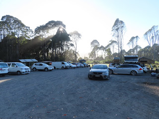
The Campground with long drop loos and a water tank.
Bins are not provided. Bring a plastic bag to take rubbish out with you.


The Redwoods, Beech Forest Victoria
I missed it on my last visit in the area. It seemed to be a very popular spot for photographers and picnic goers. I trolled along the Aire River until I reached a cliff and then returned via the road.
Nearby waterfalls: Congram Falls (close to Aire Valley Rd, few km north of Hoptoun Falls)


A revisit to Hopetoun Falls and Triplet Falls


Hopetoun Falls

Location: About 1.5 km west of Lavers Hill
Distance: 1.5 km in and out an unmaintained trail
Conditions: Muddy and slippery
It was not easy to spot the start of the walk to the fall from the road. But, the GPS file will do the job. Take your time to find a parking spot on the side of the road. The safe Uturn spot is just about 40 m further.
A little known waterfall but well worth a visit. The waterfall was at its best following recent rain. I dropped into The Perch at Lavers Hill for information about the local caravan park and I was happy to pay $9 for a glass of shandy after few days in wilderness.

Location: Shelly Beach
Access: GOR Elliott Road
Facility: carpark and a long drop loo
Distance: 4 km return, about 1h 30min incl photograph stop at River Mouth
Grade: Easy
Start from the carpark and follow the Elliott River Track down to the mouth of the Elliott River.


Elliott River Mouth
I walked up the ridge along the track and spot a snake sunbathing in the midle of the forest road. It did not know of my appearance until I made some vibration on the ground by using the trekking pole. Also it seems that we did have some eye contact. Then it moved a bit to the side of the road, stopped and then disappeared. It was between Elliott Ridge GOW Campsite and the GOW turnoff. I continued along the track and returned to the carpark via the management vehicle track.


The start of Elliott Ridge Track (part of GOW)


