Showing posts with label cliffs. Show all posts

16 November 2013

King Spur (Mt Koonika)

Area:  east of Mansfield, 68 km.  
Road unsealed after Mirimbah and winding after Telephone Box Junction.

Walk type:  Pack carry, Off track, Go and Return 
Grade:  Medium - Difficult
Guidebook:  Bushwalks in Victorian Alps, 1st Edition 2004
Maps:  Svmaps Buller-Howitt Alpine Area, Bushwalking, 1stEd 2009, Scale 1:50,000
Compass and a GPS with Garmin Topo
No water along the way until Mt Speculation.  Fill up water bottle/s at a creek before the start.
Start: Speculation and King Basin Roads Junction 
Mobile reception:  The end of King Spur near Mt Koonika

We arrived at King Hut via Circuit Road, Howqua Gap and Speculation Road on the day before the walk.  The last 2 km of Speculation Rd was a bit rough in a 4WD.  The grassy and sheltered campsite located east of King Hut was occupied.  There were few other campers on the other side of the river, which was narrow and crossable on foot or in 4WD.  Our tent was pitched on a large grassy area, which was located between the hut and the toilet.  Our neighbours were quiet and friendly.  In the late evening, we were invited to join them sharing the warmth at the fire place in the hut, but we did not, because we planned an early night and an early rise.  Just before it got dark (about 8.20 pm), a few more 4WDs arrived.

King Hut


In the morning, we were awoken by a loud noise.  Someone was trying to chop firewood.  After having breakfast and the packing for a 3-day loop walk plan including King Spur (Mt.koonika), The Crosscut Saw (Mt Speculation) and Stanley's Name Spur (Mt Thorn), we drove to the start of our walk, which was located at the junction of Speculation and Basin Roads, about 800 m away.

There was no proper marker or sign at the start, which was immediately after crossing the creek or over the bridge.  I would suggest that you take your time here to find the proper pad into the forest, that would save your time and climbing due to the heavy scrub.  We picked up the pad on our way back.  Perhaps, we were not only those, who missed the actual start.

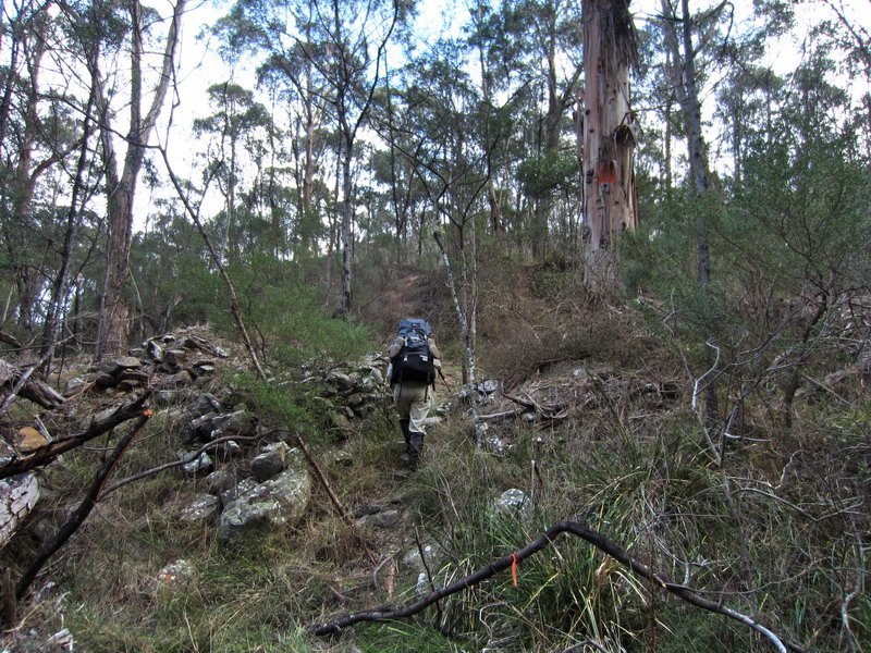
The start was rather steep and scrubby and we zig-zagged to the southwest about 500m up to the hill, rather than going due south as suggested by the guidebook.

Enjoying the first climb

 The need for a rest

For the next 2 km, we followed a faint pad climbing gently along the ridge heading east by southeast.  Then the pad became much steeper for the next 2.5 km and disappeared often, into thick, fire regrowth scrub.

At the 5km point, we turned south by southeast for about 0.5 km to reach the end of the King Spur and then continued east by northeast for 1.5 km along the spur through patches of regrowth to the end of the spur.  At that point, there was a good view of Mt Koonika across a deep valley.  The actual pad is due east across a saddle, which joins King Spur to Mt Koonika, which is a lot easier than it appears to be. 

 .. a drink

.. a meal

By the time we got to the cliffs of Mt Koonika, we were almost running out of time and water and were unable to find access to the top of Mt Koonika, and so we made camp at a flatish area, which was back down on the pad.

Sunset Koonika

 
Looking south by southeast from King Spur end

 
We were bluffed and so back here!  

It was a beautiful sunset that night and sunrise the next morning.  However, being low on water, we decided to return to the start of the walk, instead of risking a steep climb to find the top of Mt Koonika.

A warm forecast for the day

On the way down, we lost the King Spur ridge a few times due to the heavy scrub and that meant that we had to climb up several steep valley slopes to get back to the ridge.

However, we were able to take the correct pad (suggested by the guidebook) at the end of the walk, to the river, where we got a drink and a wash.

All in all, I enjoyed the King Spur ridge.  Allan did not.  It was too much for him and he does not want to do it again.  He is 60 year old and a bit over-weight.  On the contrary, I (50+) still want to tackle the circuit and very much look forward to it.

To be honest, we did not have time for the research of this walk.  Some useful tracknotes in relation to the final climb up to Mt Koonika summit were found later on.  

Maps edited before and after the walk include:

 GPS tracks on Google Earth

 Walk-in track, profile and waypoints for Day One on Garmin Topo

Vicmap and memory-map

"Go left around the rock band and then scramble up through the rock & grass"
The ks6 waypoint appeared to be missing on my GPS.

Day One plan 

A 3-day walk plan

On the drive back to Melbourne on the next day, we did some tourist stuff and visited Bindaree Waterfalls, Howqua Gap Huts, Telephone Box Junction Falls, the summit of Mt Buller and the two waterfalls on Mt Buller Road.  Click on the link to the post:  Sight-seeing after King Spur (Mt Koonika) Walk

04 May 2013

Adventure into the least visited sections of the Lerderderg Gorge

Ah Kow Tk – Lerderderg River – Bears Head Range Tk – Blackwood Ranges Tk

Update to the existing 3 to 4 day Lerderderg Gorge walk undertaken two years ago (Watties Creek (Clearwater Crk) and The Old River Circuit Walk)

The difference between the two were:
Walked in and went down to the Lerderderg River via the Ah Kow Track, unlike the previous walk, where I walked up the steep ascent from the river, and then walked out.

The reason for the return was to identify how I had missed out the Ah Kow Track on the ascent, and to find the start of the route which led down to “a waterfall” located south of The Old River.

I suggest:

  • For a short overnight walk, leave early morning.  If you want an early start, camp can be set up at the start of Bears Head Range Track.  If a late start, the night can be spent at Ah Kow camping area located just on the opposite bank of the Lerderderg River.
  • Take your time on the steep descent down to the Lerderderg River.  A trekking pole can be very helpful.  The track is so steep that I had to slide down on my backside.
  • The river was not flowing when we were there.  Only one or two decent pools of drinkable water along the dry river bed.  There may be a need to treat water.

     
    Ah Kow Tk – Lerderderg River – Bears Head Range Tk – Blackwood Ranges Tk 

    The walk started and ended at 65 Lohs Lane, which was about 600m south of Mt Black Wood.  There was a signpost at the gate.  Went through the gate, passed some worn red rail carriages, and continued on until reaching a signpost at the end of Lohs Lane, which showed Blackwood Ranges Track (about 250m from the starting point).  Turned right here and headed 130m southeast which saw us at an entry gate into the park.  Then, another 107m took us to the junction of Ah Kow and Blackwood Ranges Tracks, where route finding skills were required to find the start of Ah Kow Tk, which used to be an old vehicle track.  

     The start of Ah Kow Track

    The track now turned northeast and after a pleasant walk along for 1.06 km, we arrived at a memorial of a Melton bushwalker, which was located on a knoll at 559m.  From here, the track became narrow and the closer we got to the gorge, the steeper the track was.  Care should be taken on a 140m steep descent to an emergency marker LER 513 on the bank of the Lerderderg River.

    Emergency marker LER 513 on the river bank

    Ah Kow Track Information 

    As suggested, the Ah Kow mine site and/or camping area was just on the opposite bank of the river, where a group of Chinese had lived and grown vegetable for food in the late 1870s.  Keep an eye out for a plastic orange triangle on a big tree and an emergency marker, LER 514 could be seen up there too.  

     
    A plastic orange triangle on a big tree

    Ah Kow camping area

    Ah Kow Ruin / Lerderderg River Track Info

    The section from Ah Kow Tk to Bears Head Range Tk was dry.  The walk mainly followed the dry rocky riverbed downstream for about 2.3 km until the Old River on the left was reached.   

     Lerderderg River 

    Walked a further 100m to reach the Bears Head Range campsite, which is located on a small grassy flat above the right hand bank of the river, which is also the start of the Bears Head Range Track.   

    However, there were sufficient pools of water available in the river bed to provide water for cooking and the climb out.  So if you're heading into this section of the river, bring something to treat your water

     One of few pools of water in the river bed

    Reaching the Bears Head Range campsite

    Allan doing the packing

    The climb up the Bear Head Range track was extremely steep (the grade is 1 in 6 average) and required careful choice of route to avoid pack hauling narrow crevices..  There are lots of good views of the river on the way up and it is rather well marked with white triangles on the trees. 

     The start of Bears Head Range Track


    Lerderderg Gorge

    Me on Bears Head Range Tk with Blackwood Ranges in the background


    After 1.5 km the slope eases to 1 in 10 and the whole climb took about 2 hours. 

    Once the Blackwood Range track was reached, the walker can either take the left turn to go around the Ah Kow Reference Area or the right turn to take the walker’s track around the locked vehicle gate to follow a short four wheel drive track to the junction of the Foxy Range Track, where a right turn takes the walker back to the Ah Kow Track junction, and then allows the walker to retrace steps back to Lohs Lane carpark.  

    Junction with Blackwood Ranges Track

     Blackwood Ranges Track / Bears Head Track Info

    The walking track around the locked vehicle gate

    A challenging daywalk, or a comfortable overnight walk.  See the elevation profile of the route taken until reaching the Blackwood Ranges Track.

01 April 2013

Ironbark Gorge Circuit Walk

ParksVic Parknotes:  Werribee Gorge State Park

Walk type:  Day pack
Duration:  Half of day
Grade:  Medium
Start/Finish: Ironbark Gorge Carpark, western side of Werribee Gorge State Park
Nearest town: Bacchus Marsh, 12km
Distance from Melbourne:  64km

I did this walk just after the Beeripmo Walk over the Easter long weekend.  After I had left Richards Camp, the start / finish of the Beeripmo Walk near Beaufort, southwest Victoria, I took the Western Freeway to Ballan, where I had a quick bite, then continued on. 

It was very easy to find the entrance into Ironbark Gorge Carpark.  When I arrived there, there were about a dozen vehicles and the carpark was almost full.  By the time I got ready, it was about 1.30pm.  There was a walking track signpost at the entrance, which shows the track to Falcons Lookout, and takes 45 minutes to get there.

 Track signpost at the entrance into Werribee Gorge State Park

The Ironbark Gorge Track, which was gently down to the western side of the Ironbark Gorge, was an easy 400m walk.   

 Ironbark Gorge Track on the western side of the Ironbark Gorge

Cliff and rock-outcrop above the gorge track

Crossing the gorge, the track continued north for about 100m, then 570m NNE to reach a signposted junction, where I met two “rock climbers” on their way back to the carpark.  The helmets, which were attached to their packs, suggested me who they were.  Following the signpost, the track turned east, and then it was only about half of km easy up to the Falcons Lookout, which is the best viewpoint in the park.  I hung around here for a while for the views and some photo shoots. 

 
 View north from the Falcons Lookout 

 
The Falcons Lookout
   
Werribee Gorge and River from the Falcons Lookout  

But, my compact AA-size batteries Nikon Coolpix did not do any justice at all.  I became very disappointed while viewing the photos at home, and have thought of saving for a replacement.  Which one?  I like extended bushwalks and a pocket AA-size batteries camera is an ideal for these bushwalks, most of which would give me free-worrying from the need for electricity to charge or recharge the camera battery/ies.  Another disappoinemt is that there is almost no choice of the pocket AA-size batteries camera.  All of the current models are built with lithium batteries. 

Leaving the Falcons Lookout, I continued east along the Falcons ridge, and met up with a rock climber, who had just completed her final climb.  I cheered her up by saying that she had made it.   

 Rock-climbing cliff near Melbourne


View east from Falcons Spur

Another viewpoint

After I had passed the rock climbers, I followed the Falcons Spur, heading southeast for about one km down to the river.   

 the Falcons Spur

 Continued down..

Nearly there

The last short section of the spur was very steep and on loose rocks.  My trekking pole was put in good use.  

 
Did i have to..?

 The river at last!

 and delighted to see these orange markers

When I got down to the river, it was rather late and the low clouds looked threatening, so, I decided to shorten the walk by keeping to the right track, which provided the option to follow the Ironbark Gorge from east to west to reach the Ironbark Gorge Track.   

 
The start of the east to west Ironbark Gorge scrambling

 
Bluff view


Dry and open forest

The rock scrambling up in the gorge through some scrub was fun and it was about 1.5km length with a few bends.  I then noticed a foot pad, which led up to the signposted junction  From here, it was about 35m walk back up to the Ironbark Gorge Carpark.

Made it!
This trip was well-worth revisiting.

 GPS hiking route overlaid on the "Topo Memory-Map"