Showing posts with label packcarry. Show all posts

24 September 2018

Mt Cole/Buangor Area Overnight Walk

One hour drive west of Ballarat, just off the Western Hwy, 25km from Beaufort.
Park Victoria Map
The 3 day and 2 night walk plan: 
Day One:  Start at Chinamans Campground, north of Mt Buangor
Head south about 2km with some off-track to reach the begining of Mt Cole Reservoir Walking Track.  From here, follow the track down to the reservoir and continue south then gentlely up to Mt Buangor (987m).  Mt Buangor Walk to Ferntree Campground (night 1) past waterfalls is about 4km (about 2 hours). 
Day Two:  Ferntree - Middle Creek - Cave Hill Tk (upper level walking tk) - Sugarloaf Tk - Beeripmo Camp (night 2). If early, continue on to Mugwamp Camp 
Day Three:  Leave Beeripmo or Mugwamp Camp and head north back to car.

The lizard seen on the foot track down to Mt Cole Road on day two
Overnight Walk Chinamans CG - Mt.Cole (Ararat) Reservoir - Chinamans CG
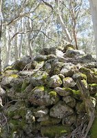
Day One:  We did not make the walk as planned. At the end of day one, we arrived at Mt Cole (Ararat) Reservoir in late afternoon, well behind schedule because we had a bit of the problem to find a reasonable way through. Hence, we decided to call it a day at the reservoir. 
I was rather slow because I had not done any pack carrying for a while, the walk was on and off the track, the terrain was steep in some places and we had a quick stop for a drink at the creek near the Pinch and Dutchman track junction and at a high point for the view over to Mt Langi Ghiran in the west. 
 
It was rather windy in the evening and we had a dehydrated green curry for dinner. Then, it was a beautiful moon light at night and we hit the sack about 9.00pm after a short discussion about the next day's options: either to walk to Mt Buangor and explore around the area with a day pack or walk around the reservoir.
Day Two: I did not sleep as well as the night before at the Chinamans CG because I forgot to zip up the sleeping bag and so felt a bit cold and woke up during the night.
We had porridge for breakfast and it was a pleasant, calm, sunny morning. Looking around, at the reservoir, the wall, the mountain ranges and the search for a camping spot yesterday, I could see that it was possible to continue on with the initial plan but it would have taken long. The option to explore around the reservoir was also abandoned. The option of going to the Mt Buangor summit and Ferntree Waterfalls sounded more inviting. Hence, we decided to walk back to Chinamans CG via an alternative route. The walk on day one followed a mostly non-existent and unmaintained track and took a lot of time to follow. The return journey mostly followed existing tracks but with many opportunities to short cut some corners to save time. We arrived early at the free Chinamans CG
(L) Mt Buangor from Mugwamp Hut, (R) Ferntree Waterfalls short walk
Day Three We drove from Chinamans CG to Mugwamp Hut and parked. BYO water at Mugwamp Hut. We took Buangor Track to the summit and the lookout side tracks and walked back via Mugwamp Track as shown in the map above.  There is a cairn and a ruined hut at the summit
Mt Buangor Track and the cairn at the summit

Langi Ghiran from Mt Buangor Lookout
We then drove from Mugwamp Hut to Ferntree via a long 2wd loop to avoid the 4wd only tracks. At the Ferntree Picnic Ground, the Cascade Falls loop is clearly marked. The walk itself is rather steep in places but has stairways to make the climb easier. It is worth the climb to see both the falls and the cascade.
My friend Allan and Ferntree Waterfalls (Right)

The top of Casecade Falls and me
Other walks in the area: Beeripmo Walk 2013Federation Weekend 2008

21 December 2013

Mt Cobbler Walk


Access from Melbourne:
  • Maroondah Hwy to Mansfield (last supplies stop), then Whitfield via Tolmie.
  • Melbourne-Whitfield (last fuel stop?) distance is 260km.
  • Whitfield-Lake Cobbler is 48km via Cheshunt (fuel stop?) and Bennies in dry season
  • After Bennies, the winding road is rough and steep in 2WD.  Take care
  • About 2-3 km before the lake, there is a view to the highest falls in Victoria.
  • Just before Cobbler Hut (unsuitable for sleeping) and campsites there is a ford, which looked crossable in high clearance 4WD.
  • If impassable, there were a few campsites on this side of the ford.
  • Insect repellent is a must.  Flies during the day, mozzies and midges at night.  Check for ants before stopping anywhere.
Walk registration is not applied.
The Walk:  10km, 2 days.  Can be done as a day walk.
Type:  Pack-carry, Go & Return with a side trip to one of the Dandongadale waterfalls
Grade:  Easy - Medium (apart from ascent to the highest peak of the Cobblers).
Start / Finish:  Lake Cobbler
ParkVic - Parknotes, Alpine NP, Valleys and Bluffs - Mt Cobbler & Wabonga Plateau
Maps: Vicmap 1:50 000, Howitt - Selwyn, Zone 55
Best time to walk:  In dry weather conditions. 
No water on the trail apart from the creek crossings at the start and about 15 minutes into the walk.

 
View of the GPS track with GE
Views of the Dandongadale Falls from Cobbler Lake Road

Day 1:  A side trip to the falls and the walk up to Cobbler Plateau to camp
 
We spent a bit of time exploring one of the three Dandongadale falls with a day-pack.  The start of the track to the first falls (the cascades) was immediately after crossing the ford.  It was an easy short walk to the top of the falls, which offered view of Mt Typo and Warrick in Wabonga Plateau to the north.  The rocky slab platform was pretty slippery and so take care.  More good views of the falls can be seen from the base but the going is rather scrubby and steep.  There were also some fallen trees and I was able to manage to climb over them to reach the creek and waded a bit to get close to the falls.  It was worth, the effort.  I would love exploring further, but had to turn back because Allan was waiting somewhere nearby.  Meeting up with Allan again, we retraced our steps back to the top of the falls and then back to the car for a cooked lunch and a cup of tea.

View north from the top of the cascades.

First cascade 

Second cascades
 
 Slipery rocky slab.  Take care

      View at the bottom of the 2nd cascades    View of the cascades through trees

After lunch, we got ready for the pack-carry walk.  Our aim was to camp near the junction of Lake Cobbler and Speculation Tracks and then to head for the Mt Cobbler summits the next day with a day pack.  There was no water at the campsite, so we had to carry all water for drinking and cooking.  Luckily, there was only a short walk up to the plateau.

Before leaving for the walk, the car was relocated so that the campsite could be used by others.  It was a little noisy when vehicles and motor bikes passing during the day, but pretty quiet at night.  All together, we saw about 15 vehicles and about 18 motor bikes.  As a rule of thumb, we took a GPS way point of the car / the start before shouldering our packs.  We crossed the ford, passed the pad to the cascading falls and the hut.  There is a sign post at the start of Mt Cobbler Walking Track just beyond the hut.  The sign showed 4km, 2hrs return and was intended for walkers with day packs.  We crossed a creek and followed the track for about 15minutes to reach the Dandongadale River / Creek where we stopped for a drink and photos. 
 Lake Cobbler Hut (unsuitable for sleeping)

Lake Cobbler

Near the start of Mt Cobbler Walking Track

Approaching Dandongadale River/Creek

Past the creek is a steep climb, which quickly levels off to a moderate slope.  It was a well-marked track with ribbons and triangles.  Near Mt Cobbler, Cobbler Lake and Speculation Tracks junction, the track reaches a plateau with good campsites all around the junction.  We chose a campsite about 150m up the Mt Cobbler track.  It was a good campsite, with a good view of Mt Cobbler peaks and the ridge, but there is no water and a lot of ants.

The Cobbler Plateau

Day 2:  Ascent of Mt Cobbler

We started early for the Mt Cobbler summits, with day packs only, so we could avoid the afternoon heat on the shadeless summits.  The track to the summit is easily followed through the scrub and when you get to the rocky part, the route is marked by cairns where the track is not obvious.


Wild flowers along the pad to the summit


Do we have to climb up there?

Mt Cobbler Peak

The summit track leads to a minor peak with good 360º views of the surrounds, but the highest point is on a peak, that is separated from this minor peak by a chasm.  While this chasm looks difficult to cross, there is a path up to the summit with only one tricky spot to climb (carry a light and compact day pack), about 30m into the ascent of the summit.  After that, it is relative easy climbing.  Note the location of the difficult spot, as this is the only way down.  A handkerchief tied to a low scrub would do the job.

                                     View east from the chasm
                      The chasm & the minor peak   

The views from the summit are superb.  Allow at least an hour on the summits to take in the 360* views of Mt Koonika, Mt Speculation, Mt Buggery, The Crosscut Saw, Mt Buffalo, Mt Buller, ..         

Great Dividing Range (Barry Mountains) from The Cobbler Summit

Northern part of Mt Cobbler from the peak

NNE view of Mt Buffalo area

 Southeast view of Mt Konika, Mt Speculation, The Crosscut Saw, ..

SSW view of Mt Howitt, Mt Stirling and Mt Buller area

 West view of Mt Samaira and Strathbogies Ranges area

The return journey is to retrace our steps back to Lake Cobbler, with a refreshing drink and wash in the headwaters of the Dandongadale River.

On way back to the Cobbler Plateau

16 November 2013

King Spur (Mt Koonika)

Area:  east of Mansfield, 68 km.  
Road unsealed after Mirimbah and winding after Telephone Box Junction.

Walk type:  Pack carry, Off track, Go and Return 
Grade:  Medium - Difficult
Guidebook:  Bushwalks in Victorian Alps, 1st Edition 2004
Maps:  Svmaps Buller-Howitt Alpine Area, Bushwalking, 1stEd 2009, Scale 1:50,000
Compass and a GPS with Garmin Topo
No water along the way until Mt Speculation.  Fill up water bottle/s at a creek before the start.
Start: Speculation and King Basin Roads Junction 
Mobile reception:  The end of King Spur near Mt Koonika

We arrived at King Hut via Circuit Road, Howqua Gap and Speculation Road on the day before the walk.  The last 2 km of Speculation Rd was a bit rough in a 4WD.  The grassy and sheltered campsite located east of King Hut was occupied.  There were few other campers on the other side of the river, which was narrow and crossable on foot or in 4WD.  Our tent was pitched on a large grassy area, which was located between the hut and the toilet.  Our neighbours were quiet and friendly.  In the late evening, we were invited to join them sharing the warmth at the fire place in the hut, but we did not, because we planned an early night and an early rise.  Just before it got dark (about 8.20 pm), a few more 4WDs arrived.

King Hut


In the morning, we were awoken by a loud noise.  Someone was trying to chop firewood.  After having breakfast and the packing for a 3-day loop walk plan including King Spur (Mt.koonika), The Crosscut Saw (Mt Speculation) and Stanley's Name Spur (Mt Thorn), we drove to the start of our walk, which was located at the junction of Speculation and Basin Roads, about 800 m away.

There was no proper marker or sign at the start, which was immediately after crossing the creek or over the bridge.  I would suggest that you take your time here to find the proper pad into the forest, that would save your time and climbing due to the heavy scrub.  We picked up the pad on our way back.  Perhaps, we were not only those, who missed the actual start.

The start was rather steep and scrubby and we zig-zagged to the southwest about 500m up to the hill, rather than going due south as suggested by the guidebook.

Enjoying the first climb

 The need for a rest

For the next 2 km, we followed a faint pad climbing gently along the ridge heading east by southeast.  Then the pad became much steeper for the next 2.5 km and disappeared often, into thick, fire regrowth scrub.

At the 5km point, we turned south by southeast for about 0.5 km to reach the end of the King Spur and then continued east by northeast for 1.5 km along the spur through patches of regrowth to the end of the spur.  At that point, there was a good view of Mt Koonika across a deep valley.  The actual pad is due east across a saddle, which joins King Spur to Mt Koonika, which is a lot easier than it appears to be. 

 .. a drink

.. a meal

By the time we got to the cliffs of Mt Koonika, we were almost running out of time and water and were unable to find access to the top of Mt Koonika, and so we made camp at a flatish area, which was back down on the pad.

Sunset Koonika

 
Looking south by southeast from King Spur end

 
We were bluffed and so back here!  

It was a beautiful sunset that night and sunrise the next morning.  However, being low on water, we decided to return to the start of the walk, instead of risking a steep climb to find the top of Mt Koonika.

A warm forecast for the day

On the way down, we lost the King Spur ridge a few times due to the heavy scrub and that meant that we had to climb up several steep valley slopes to get back to the ridge.

However, we were able to take the correct pad (suggested by the guidebook) at the end of the walk, to the river, where we got a drink and a wash.

All in all, I enjoyed the King Spur ridge.  Allan did not.  It was too much for him and he does not want to do it again.  He is 60 year old and a bit over-weight.  On the contrary, I (50+) still want to tackle the circuit and very much look forward to it.

To be honest, we did not have time for the research of this walk.  Some useful tracknotes in relation to the final climb up to Mt Koonika summit were found later on.  

Maps edited before and after the walk include:

 GPS tracks on Google Earth

 Walk-in track, profile and waypoints for Day One on Garmin Topo

Vicmap and memory-map

"Go left around the rock band and then scramble up through the rock & grass"
The ks6 waypoint appeared to be missing on my GPS.

Day One plan 

A 3-day walk plan

On the drive back to Melbourne on the next day, we did some tourist stuff and visited Bindaree Waterfalls, Howqua Gap Huts, Telephone Box Junction Falls, the summit of Mt Buller and the two waterfalls on Mt Buller Road.  Click on the link to the post:  Sight-seeing after King Spur (Mt Koonika) Walk