25 May 2025

Dinner Plain

Dinner Plain is a nice little snow village that also offers a great location for outdoor adventurers in Summer. The alpine village of Dinner Plain is located 13 km southeast of Hotham Village, just about 20 minutes for a slow driver like mine.


There was a huge construction project outside the Visitor Info Centre and I had a quick stop to pick up an official walk guide for the Dinner Plain area. I arrived at the planned destination and it was lucky to find a suitable spot for my little car camping tent, a previous light weight hiking tent that is easy and fast to pitch.
 

 Day shelter Carpark
 
 
 My neighbour's 4WD with a rooftop, a perfect arrangement for two.
 
It was early enough for a walking tour around the ski resort.


Mt Tabletop WT (Square Mount)

Distance: 10 km return. Grade: medium
Track: marked by orange triangular markers
Map: See the Dinner Plain Tracks & Trails map in the Montane WT, Precipice Plain Lookout, and Carmichael Falls Walk blog. 
 
Start / End: JB Plain Hut / Walk-In Campground about 100 m off Great Alpine Road (B500) and
about 1.5 km west of Dinner Plain Village. 
 
Access to a drop loo. BYO water. 
 
 
 JB Plain Hut with campground.
 
Path across the plains for 0.5 km.
 
Crossing the snowgum woodland. 
 
 Mt Tabletop from the track 


The plateau. Watch out for snakes on a sunny day.
Return by the same route. 
 
I returned early enough to take a short walk up to Dead Timber Hill Lookout (about 30 minutes return with a break or two and photos). The start is on the other side of the road and opposite to the car park. The track is signposted.

Mt Feathertop from Dead Timber Hill Lookout.

 Well worth a climb

What a view!
I returned by the same route.

But, you could continue on this track, Dead Timber Hill WT and walk east for about 1.5 km which will take you to the start of Room with a View Walking Track (easy, 3 km return).
 
Room with a View WT taking you through the snowgum forest to an open plain.
 
 
Views of Mt Hotham, Mt Feathertop, Bogong High Plains, and the Cobungra River are from the lookout at Room With A View

Mt Loch Summit

A short easy day walk/hike, a few kilometres northwest of Hotham Heights and a few kms east of The Razorback. See the Mt Feathertop Walk Map in the Mt Feathertop via The Razorback Walk blog.

Distance: 7 km. Return the same way.

Time: About 3 hrs including breaks and photography

Track: Vehicle track with signposts. The walking track is a Hotham 'Ski' Trail in Winter.
 
Start/End: Mt Loch Carpark next to a day shelter building on Great Alpine Rd - Mt Hotham,
1 km west of Mt Hotham Visitor Information Resort Management.
 
Also the start and end of Falls to Hotham Alpine Crossing (37 km, 3 day hike).

Good views of the High Plains, Mt Hotham and the east face of Mt Feathertop from the walking track.
 

Mt Loch from Pole 60
 
Mt Loch summit, 1887 m. offers good views of Mt Fetheartop, Mt Jaithmathang, Mt Fainter.

 
Mt Hotham and Mt Feathertop from the gate near the Loch carpark.
 
 
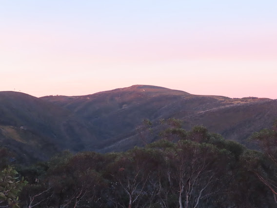
Such a magic light on Hotham from the setting sun. These photographs were taken from Great Alpine Road.

 
 Mt Higginbotham 


Just stopped for photographs. Imagine the cost to stay in one of those. Nah, not for me.


Looking south from Hotham Village Corral Carpark with an Information Board of locations, a Visitor Shelter for the local, travellers / hikers and skiers waiting for their shuttle bus. The wind and the chill did not bother me and it was well worth the effort of waiting for the glowing sunset over the ranges.

 Golden magic light covered Dargo High Plains, Blue Rag Ranges, and more.


Had to be quick. My last opportunity to take photos of the sunset show with Mt Hotham and Mt Feathertop.What a day! 
Dinner Plain snow village and Walking Tracks