04 January 2021

Minnow Falls Climb

Headed to Minnow Falls on the East side of Mt. Roland for the day.  A 600m climb from Bottom Road to the top fall.  A bit light-on for water too.  Weather was good but the climb was almost vertical in places and the track was "misplaced" a few times so we got back to the car after dark.


Headed west up to the waterfalls.  Traversed south and east then bushbashed about 500m north to get back.
Well-maintained and well-marked on the track up to Minnow Falls.  
The Low Level for the return to the car follows the orange marker.

 
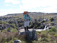
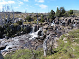
Bottom and Top falls.  Allan looked comfy and enjoyed lunch up there.
We took the old track High Level Circuit Down.  

Across the ridge, a cave and three ladders were found.  

 
Down the escarpment.  
Notes to The Old Track Circuit hikers: Be well-prepared and equipped and start early.

Duncanson Falls

Nearest town is Deloraine (South) and it's about 5km from Great Lake North.  Access from Lake Highway A5 of the Great Western Tiers in the alpine Central Plateau.  There was no track to follow and it was a slow going because of difficult terrain.  However, it was worth to tackle it

Hiking GPS trail on Topo 100k

Did a 6 hour walk from Pine Lake to an overnight camp at Duncanson Falls on the central plateau, across 8 kms of peat bogs, scree slopes and scoparia thickets.  It was very cold and a bit wet too by the end of the day.

A cairn was seen shortly after leaving the northern shore of Pine Lake and it was also the start of bush bash and rock hop.  Adams Peak from the alpine central plateau.  I had been up there before with a day pack.  Wild flower out in late March.
Duncanson Falls in the evening.  About 300m after the crossing at Duncansons Rivulet. 
 
A bit of time spent on looking for a shelter tent site.  Very exposed up there.

Walked for 6 hours across scoparia infested peat bog back from Duncanson Falls on the Central Plateau.  It was much better weather though. 

Morning view from the camping spot.  If weather permitting, we would love to stay another day here
 to go further exploring.  Warners Falls and Havelock Falls were not far away, just about 1km north of 
us.  It was also on the walk out if doing the circuit.
Photo op - pack on and off again.  Duncansons Falls and Ritters Crag.  Will be back.

Day 1 and 2 lunch stops.  Back to Pine Lake car park.

02 January 2021

Around Cradle Mountain

 Walked the Overland Trail from the start at Ronny Creek car park on Cradle Mountain Road in Cradle Valley to the turnoff for the Scott Kilvert Memorial Hut via Crater Waterfalls, Marions Lookout and Kitchen Hut. 

Map of Cradle Mountain area taken in Rangers Hut (emergency shelter).

Photographing Crater Falls and Dove Lake.

Lake Dove & Mt Campbell from Marions Lookout,  Cradle Mtn and Barn Bluff from the OT

The walk from the Overland Track to the hut was a killer downhill and also the park authorities had directed all the Overland Track first nighters down to the hut too.  Apparently the Waterfall Valley hut is being refurbished.  First time I (Allan) have seen the south side of the Cradle Mountain ridge.

Benson Peak from Lake Rodway Track and
Scott-Kilvert Memorial Hut with tent platforms and Lake Rodway.

Day 2 of the overnight circumnavigation of Cradle Mountain and we decided not to go up the Cradle Mountain peak, but went down the Twisted Lake back track instead.

Flynns Tarn, Lake Rodway and Mt Emmett from the Rodway Track
Twisted Lakes and Mt Campbell from the track

There were more steep downhills and we were back to Dove Lake car park for the last bus out with 20 minutes to spare. Will be lazy tomorrow to recover from a hard two day walk.
Lake Dove and Cradle Mt in the early evening.