02 January 2021

Grail Falls Climb

Overnight walk to Grail Falls at 1040m. Started at Mersey Forest Road end at 500m.

GPS Garmin track on MM Topo 25k.

Log book and Jacksons Creek bridge where there was a bio station for boots cleaning to prevent the propagation of the fungal disease that shows in the photograph located next to the map.

 
Lunch break with lovely creek water.  I have been here a few times on extended walks to Cathedral Mountain and Mountains of Jupiter Base.  Had camped here before and had had fun with the leeches.  Pack on again to get ready for the start of the climb.  A dry tarn and comfy seats were found when we were high up and it was also a good time for a rest after all the hard work.  But then had to be careful with our steps to get down there.  Thankfully, there were foot holds and hand holds.
Bottom of Grail Falls camp, South of Chapter Lake
 
Grail Falls in the evening.  The L & R photos were taken by Allan with a better sensor camera.
Top of Grail Falls and Chapter Lake

Next day: Return from Grail Falls while doing an aborted side trip to Meribah and Horeb Falls, due to difficult terrain. Our mistake was taking a high route. We went too much further up. Will try again as a day walk in the near future with the start near the junction of Jacksons Creek and Moses Creek.

Grail Falls in the morning.  It was worth hunting down an unknown waterfall near yesterday lunch stop and it's given a name of Dzung's falls by Allan.  Next was a short and pleasant walk to complete the return.
Link to Hikes and Waterfalls of Tasmania 2020
31 December 2020

Paddys Nut from Maggs17

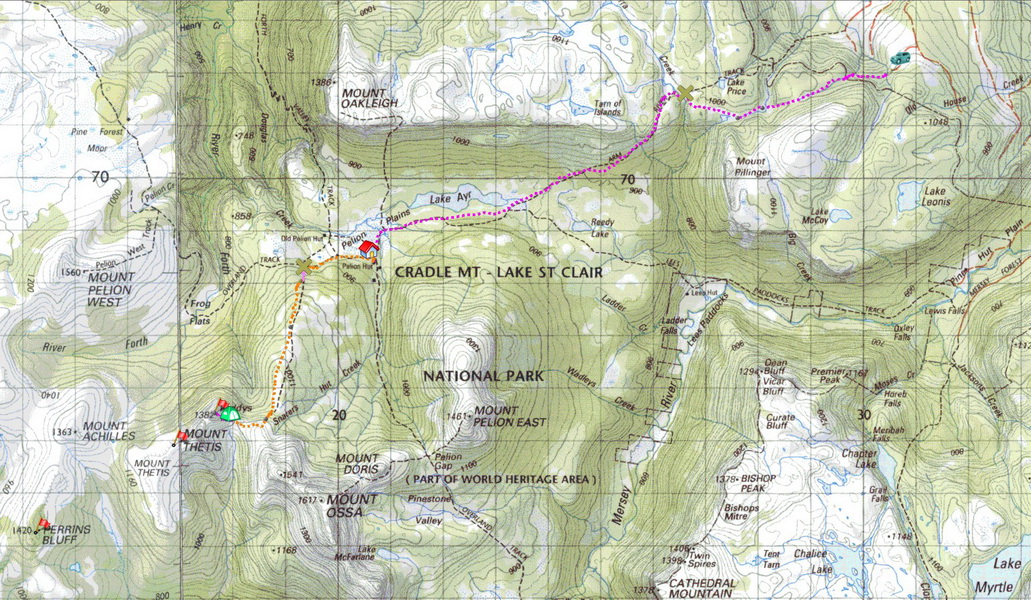
Set out for a 5 day walk from our van camp at the Lake Rowallan dam wall on the Mersey River Road.  First went by car to the the Maggs 17-1 "road" car park, then on foot via the Maggs 17 track and Arm River Tracks to Pelion Hut and then onto Paddys Nut (a peak near Mt Ossa) and back. 

GPS Track on Memory-Map Tasmania 100k

It was a long 6 hour hike from the Maggs 17-1 car park  to the New Pelion Hut (on the OT) thru waterfall filled gullies, button grass and peat marsh.


Waterfalls on Maggs 17 Track 

   
Mt Pillinger from Maggs17 Tk (navigation skills required).  Reached Arm River Track.  
Arrived late evening and camped out.  The hut and the campground were full.

The second day was another 6 hour, 400m, uphill battle, with indistinct tracks, leeches and bogs, to a campsite at the base of Paddys Nut.  

Photos (on the walk out) used to identify features.  PaddysNut basecamp on day 2
Allan with Mt Ossa 1617m in the background.  PaddysNut and Mt Thetis from Paddys Tk

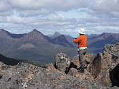
The next day started foggy but turned into a glorious clear afternoon with clear skies, and cool sun allowing a magnificent view of all of the Pelion area from the top of the Nut.  


Worth the climb up to the summit of Paddys Nut 1382m and Allan enjoyed views.  
Mt Thetis from PaddysNut.  Been myself almost the top last time some years ago.  
Mt Ossa and Mt Pelion East in the distance.
Mt. Thetis, Mt. Achilles 1363m, Perrins Bluff 1420m and Mt Pelion West 1560m 
Barn Bluff and Cradle Mtn 


Mt Oakleigh 1386m, Cathedral Mtn 1378m and Barn Bluff from Paddys.

Mt Ossa 1617m and Paddys 1382m

The next day was the reverse trip from the Nut, but was a bit drier and we saw two bush fires start on the way down. neither very close, fortunately.

 
Mt Pelion East, Mt Pelion West, the Nut - PelionWest and Barn Bluff.

 
Barn Bluff , Cradle Mountain 1545m and the New Pelion Hut Campground

The last night at Pelion Hut, our tent was attacked by a possum and the inner tent floor has been ripped.  Will need a repair or replacement (bugger!).  The last day reversed the trip from Pelion Hut to the Maggs17-1 track where the car was parked.  
Pelion Plain and Mt Pelion West

 
Lunch stop near Lake Ayr on Arm River Tk.  Wurragarra Creek near the Maggs turn-off .