The Drive: Bright (B500) - Mt Beauty (C531) - Falls Creek - Pretty Valley Road (unsealed) - Pretty Valley Hut / Campground - Pretty Valley Pondage (around 7.5 km from Falls Creek Village).
The Start: Pretty Valley Pondage at Pretty Valley Road End. Limited parking here. No facilities.
It is recommended to park at Pretty Valley Campground with a drop loo.


Looking northeast with view of the camping area from Pretty Valley Pondage parking area (L)
Looking north with view of Mt Mckay, Tower Access Track, and Mckay Creek Fire Track (R)
It was cold and windy and I did not bother to boil water for tea. I had a quick bite while doing the final packing for an overnight walk. Two fly-fishing men just got back for their lunch and I did not hesitate to come over and have a chat to find out if there was water at Tawonga Huts/Campground. I was rather surprised that they had never been to the huts.
By midday, I was ready to leave. It was an easy 4 km walk to the Tawonga huts / Campground. I stopped at the Park Victoria Information sign about the track: how far, how long, etc. There was a gate at the crossing and I followed the Fainter Fire Trail to the west.

Looking back after walking across the pondage: the road in, the parking area, the information sign, the MVO gate, the snow poles, and the Fainter Fire Trail that I was on.

Look north from the trail from right to left: the road in, the parking area, and Mt Mckay Summit Rd.


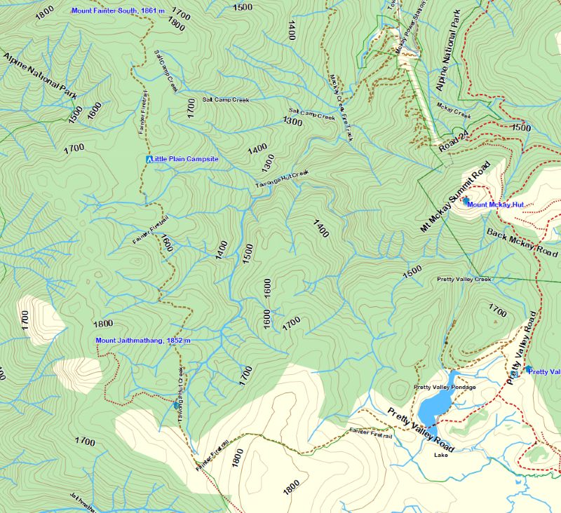
The junction of Fainter Fire Trail and the footpad to Pole 333 on Falls to Hotham Alpine Crossing (37 km, 3 days), part of the Australian Alps Walking Track (AAWT) long distance (650 km) multi-day walk, which starts from Wahalla and ends at Canberra.
There were a few hikers on the trail. A couple were on the way back to the pondage and the solo walker who just overtook me. I was pleased to know that there was creek water at the campground.

The 1 km track down Tawonga Huts Camping Area


Arrived at the huts with a large camping area early enough to look around. The first thing was to check out the creek water if it was clean and safe enough for drinking without treatment. Also, nearby was the signpost for the start of tomorrow's walk. The next task was trying to locate a loo. Then, it was a short visit to the huts, the two of which can be used to provide shelters in case of bad weather and/or to keep cross-country skiers warm.
So far so good, I walked back to the campsite and pitched up the tent. It was not windy and the ground was soft and so it was easy to have it up in minutes.


A tentsite with a view. I had to be quick for the first photograph of the Flame Robin and seemingly she was happy to pose. A big thank you and please come back. You are always welcome. She came back and tried to get my food from me. I knew what you wanted, mate and here you were ..


Tawonga campsite with Mt Jaithmathang Ridge in the background (L), Mt Mckay (R)

Room with a view from the camping area.


From L to R: Bogong High Plains, Mt Fainter, and Mt Mckay
It was lucky that I had the place to myself. The camera was kept busy all the evening. It was very cold outside after the sun went down and I decided to cook and have dinner with the head torch in the small
hut, in which I also had breakfast the next day.


Fainter Fire Trail after passing Mt Jaithmathang foot track.
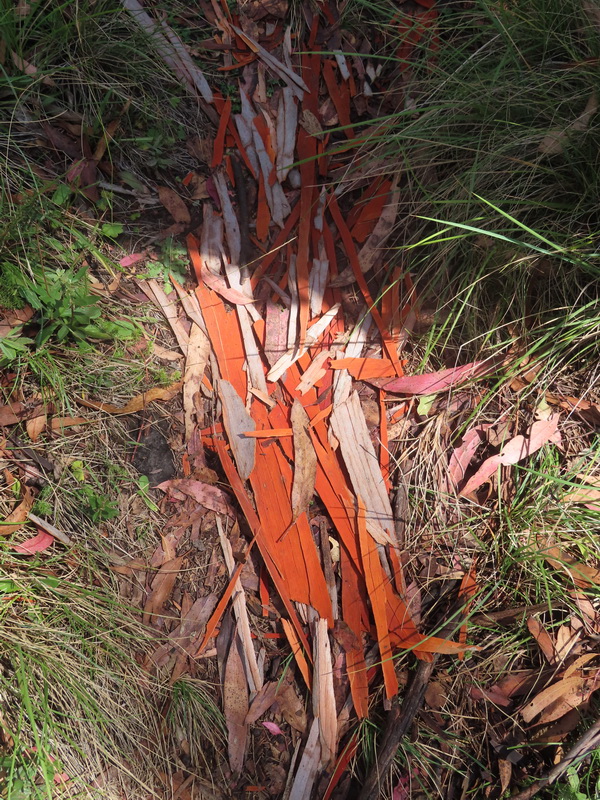
Crossing a stream with water flowing down Tawonga Hut Creek.
Starting off, I made the mistake of walking down the Fainter Fire Trail rather than taking the turn at the start of the walk up Mt Jaithmathang, 1852m as planned. I failed to take the loop walk tackling the Mt Jaithmathang ridge then heading east down Fainter Fire Trail, at which there were two options available included: 1/ do Fainter South or 2/ return to Tawonga huts. The decision would depend on how much time I had remaining.
Poor me. I was too lazy to take out the map and have a look at it at the signpost. I could have taken the turn off and walked a little further to see how the Jaithmathang footpad looked like. I wonder why I did not because it was possible that Fainter Fire Track was more of a single track and so inviting that I kept going on and on.
Above (R) is where water can be refilled, if you are continuing to walk north towards Mt Fainter South, 1861m.

Heading towards Little Plain
 Mt Mckay Summit to the east
I had a late lunch at Salt Camp Creek. Collect water here if you plan to camp at Mt Fainter South, 1861m. I did not make it to the summit and it seems an easy climb and I wished I had my camping gear with me
I was not alone on the trail. When I was having a break with an oat slice and a drink, a local on his mountain bike rode past. He was on his way to Mt Beauty where he lives. I admired him for doing so because the trail was rather rocky and narrow in some parts.


Wild flower (Hoary Sunray) and snow gum
I returned by the same route.
Unlike yesterday when I had the place to myself, the campground became a tent city this evening. There was a large school group and few of the students were very annoying.
I was so lucky with yesterday's sunset photos. It was worth spending the time moving around for photography when given the opportunity. After a quick dinner and a refresh, I called it the day. There was a warning about a change in the weather for tomorrow in the late afternoon and I had to be out on the road before the change came.

Mt Jaithmathang from Fainter Fire Trail
On
the walk out by returning on the same route I walked in, another school
group was heading in. A small sized group compared to the large one at
the huts. A quick warning was passed on: 'be prepared, stormy and wet day/s ahead'. We
all had a laugh.

About to reunite with the car. Yup, she was still there.
Pretty Valley, Rocky Knobs 1780 m, Bogong High Plain ..

Last
view from the parking area. The two fly-fishing men are still here and
hope they have had some luck with the fishing. After a safety check for
the drive back up the steep hill, the car was on the road again.

I had a quick stop at this junction for a photograph that will be useful for a hiking plan in the future. It is the junction of Pretty Valley Road and Pretty Valley Track, which is around 1 km from the Pretty Valley Pondage parking area. Also, nearby is Pretty Valley Campground around 250 m further along the road. There is a drop toilet, but no other facilities and it is free to camp there.
Summing up The walk I actually did:
Fainter Fire Trail - Tawonga Huts - Little Plain - Mt Fainter South (almost) - Return by the same route.
It was an enjoyable pack-carrying hike with a gentle ascent and stunning panoramic views.
Suggestion: Avoid walking / hiking / camping over a long weekend and during school holidays if you want to avoid crowds.